Data
- Obtaining
- Supplying
- High-Frequency
- Bottom Pressure Records
- Other Long Records
- GLOSS/ODINAFRICA Calibration Data
Donate
Donate to PSMSL
Data Notes
- Individual Station Data and Plot Notes
- Referencing the Data Set
- PSMSL Help File
- 2010 Changes to the PSMSL Data Files
Extracted from Database
03 Mar 2025
Station Information
| Station ID: | 1081 |
| Latitude: | 44.65 |
| Longitude: | -67.216667 |
| Coastline code: | 960 |
| Station code: | 197 |
| Country: | UNITED STATES |
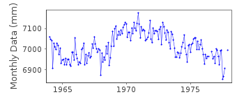
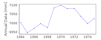
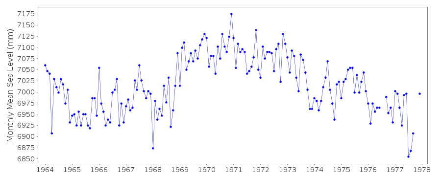
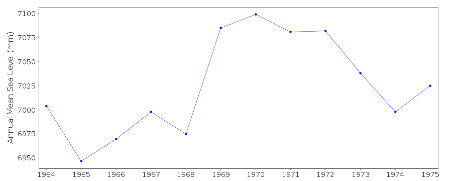
| Time span of data: | 1964 – 1977 |
| Completeness (%): | 98 |
| Date of last update: | 01 Jan 1980 |
| Green Arrow: | Current Station |
| Yellow Marker: | Neighbouring RLR Station |
| Red Marker: | Neighbouring Metric Station |
Please note: In many cases, the station position in our database is accurate to only one minute. Thus, the tide gauge may not appear to be on the coast.
Tide Gauge Data
Additional Data Sources (guide to additional data sources)
Nearby GNSS Stations from SONEL: MEMANearby Real Time Stations from VLIZ: cwme, cwme2
Station Documentation
Link to RLR information.Documentation added 1991-06-11
Cutler 960/197 RLR(1974) is 9.9m below BM3Documentation added 1993-07-12
Cutler 960/197 RLR(1974) is 9.9m below BM3Documentation added 2012-02-29
Cutler is an Historic station last data is that for 1977 Primary benchmark wasBM 3 6.498m above gauge datum. This station no longer features on the NOAA
website
but a new gauge was installed at Lat. 44 39.4N Long. 67 12.6W in November 2010.
Data Authority
N.O.A.A. / N.O.S.N/oes33, Ssmc4, Room 6531
1305 East-West Highway
Silver Spring,
MD 20910

![]()
![]()
![]()
