Data
- Obtaining
- Supplying
- High-Frequency
- Bottom Pressure Records
- Other Long Records
- GLOSS/ODINAFRICA Calibration Data
Donate
Donate to PSMSL
Data Notes
- Individual Station Data and Plot Notes
- Referencing the Data Set
- PSMSL Help File
- 2010 Changes to the PSMSL Data Files
Extracted from Database
03 Mar 2025
Station Information
| Station ID: | 1663 |
| Latitude: | 37.583333 |
| Longitude: | -122.25 |
| Coastline code: | 823 |
| Station code: | 34 |
| Country: | UNITED STATES |
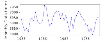
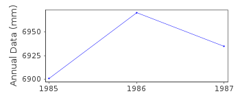
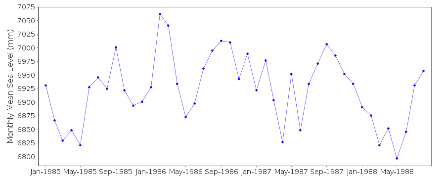
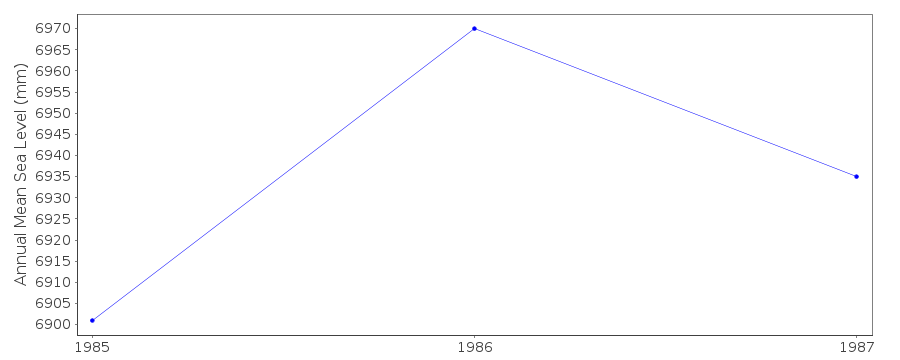
| Time span of data: | 1985 – 1988 |
| Completeness (%): | 92 |
| Date of last update: | 21 Jun 1990 |
| Green Arrow: | Current Station |
| Yellow Marker: | Neighbouring RLR Station |
| Red Marker: | Neighbouring Metric Station |
Please note: In many cases, the station position in our database is accurate to only one minute. Thus, the tide gauge may not appear to be on the coast.
Tide Gauge Data
Station Documentation
Link to RLR information.Documentation added 1991-06-11
San Mateo 823/034 RLR(1986) is 9.4m below BM Guano Is 1851Documentation added 1993-07-12
San Mateo 823/034 RLR(1986) is 9.4m below BM Guano Is 1851Documentation added 2012-01-26
This is an historic station. Last data value received is that for August1988. Station has been labelled 'inactive'. Before the data ended the
Primary benchmark was changed to BM 1 9.576m relative to gauge datum.
Data Authority
N.O.A.A. / N.O.S.N/oes33, Ssmc4, Room 6531
1305 East-West Highway
Silver Spring,
MD 20910

![]()
![]()
![]()
