Data
- Obtaining
- Supplying
- High-Frequency
- Bottom Pressure Records
- Other Long Records
- GLOSS/ODINAFRICA Calibration Data
Donate
Donate to PSMSL
Data Notes
- Individual Station Data and Plot Notes
- Referencing the Data Set
- PSMSL Help File
- 2010 Changes to the PSMSL Data Files
Extracted from Database
13 Jul 2026
Station Information
| Station ID: | 1836 |
| Latitude: | -38.547194 |
| Longitude: | 143.988833 |
| Coastline code: | 680 |
| Station code: | 226 |
| Country: | AUSTRALIA |
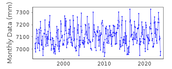
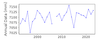
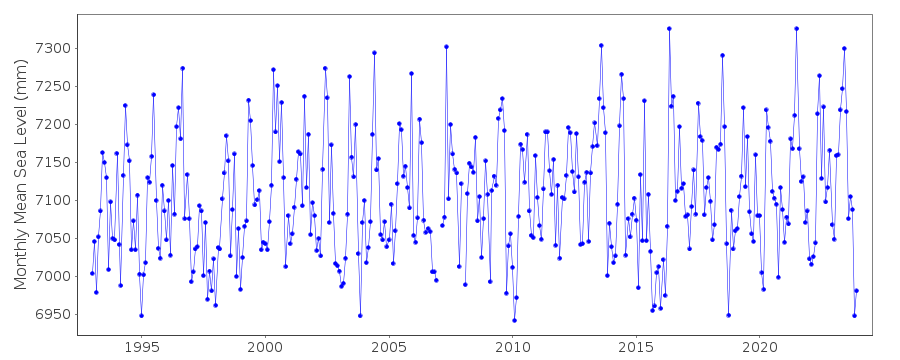
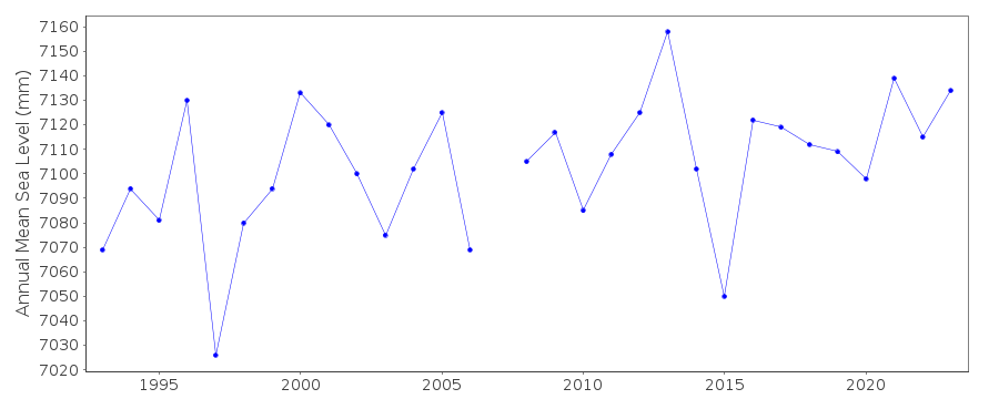
| Time span of data: | 1993 – 2025 |
| Completeness (%): | 96 |
| Date of last update: | 20 Mar 2025 |
| Green Arrow: | Current Station |
| Yellow Marker: | Neighbouring RLR Station |
| Red Marker: | Neighbouring Metric Station |
Please note: In many cases, the station position in our database is accurate to only one minute. Thus, the tide gauge may not appear to be on the coast.
Tide Gauge Data
Station Documentation
Link to RLR information.Documentation added 1995-05-02
Station density along some sections of the Australian coast has meant that station codes 601 onwards have been re-ordered compared to those in earlier versions of the PSMSL data set.Documentation added 1996-03-28
SEAFRAME station - owned and operated by the Port of Melbourne AuthorityDocumentation added 1996-04-02
SEAFRAME station installed January 1993Documentation added 1997-12-23
1995 revised in update from National Tidal FacilityDocumentation added 2000-04-10
This is a "baseline station" of the Australian National Tidal Facility.Documentation added 2000-04-10
Lorne 680/226 RLR(2000) is 33.974m below PM19Documentation added 2011-10-24
Using informtion from the National Tidal Centre, Australia the RLR diagram has been revised.Benchmark PM19 is 28.374m above TGZ. Benchmark SUTRON is 4.461m above TGZ. The natinal datum reference AHD is 1.423m above TGZ. RLR factor is 5.6m.Documentation added 2019-01-23
Data values for June, July and October 2016 have been revised.Documentation added 2021-02-03
As well as 2020 data values for February, March and May 2018 have also been updated.Data Authority
National Tidal CentreBureau of Meteorology
PO Box 421
Kent Town 5071
South Australia
Documentation added 2010-08-12
Formerly known as the National Tidal Facility

![]()
![]()
![]()
