Data
- Obtaining
- Supplying
- High-Frequency
- Bottom Pressure Records
- Other Long Records
- GLOSS/ODINAFRICA Calibration Data
Donate
Donate to PSMSL
Data Notes
- Individual Station Data and Plot Notes
- Referencing the Data Set
- PSMSL Help File
- 2010 Changes to the PSMSL Data Files
Extracted from Database
03 Mar 2025
Station Information
| Station ID: | 1911 |
| Latitude: | 35.35 |
| Longitude: | 33.333333 |
| Coastline code: | 315 |
| Station code: | 10 |
| Country: | CYPRUS |
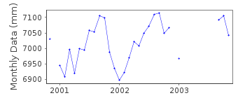
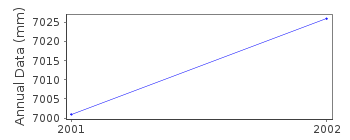
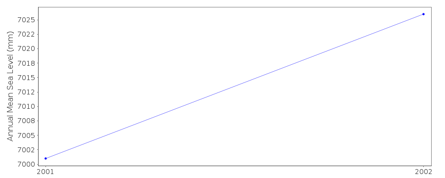
| Time span of RLR data: | 2000 – 2003 |
| RLR completeness (%): | 58 |
| Time span of metric data: | 2000 – 2011 |
| Metric completeness (%): | 44 |
| Date of last update: | 12 Jun 2012 |
| Green Arrow: | Current Station |
| Yellow Marker: | Neighbouring RLR Station |
| Red Marker: | Neighbouring Metric Station |
Please note: In many cases, the station position in our database is accurate to only one minute. Thus, the tide gauge may not appear to be on the coast.
Tide Gauge Data
Station Documentation
Link to RLR information.Documentation added 2013-01-09
Data for Girne 2009 onwards has been supplied by Cemal Saadetoglu, Directorof the Mapping Department in the Turkish Republic of Northern Cyprus
Data Authority
Mapping DepartmentMinistry of Housing
Lefkosa
Via Mersin-10
Turkish Republic of Northern Cyprus

![]()
![]()
![]()
