Data
- Obtaining
- Supplying
- High-Frequency
- Bottom Pressure Records
- Other Long Records
- GLOSS/ODINAFRICA Calibration Data
Donate
Donate to PSMSL
Data Notes
- Individual Station Data and Plot Notes
- Referencing the Data Set
- PSMSL Help File
- 2010 Changes to the PSMSL Data Files
Extracted from Database
03 Mar 2025
Station Information
| Station ID: | 1919 |
| Latitude: | 41.433333 |
| Longitude: | 32.233333 |
| Coastline code: | 310 |
| Station code: | 26 |
| Country: | TURKEY |
| Time span of data: | 2001 – 2009 |
| Completeness (%): | 90 |
| Date of last update: | 24 Jun 2010 |
| Green Arrow: | Current Station |
| Yellow Marker: | Neighbouring RLR Station |
| Red Marker: | Neighbouring Metric Station |
Please note: In many cases, the station position in our database is accurate to only one minute. Thus, the tide gauge may not appear to be on the coast.
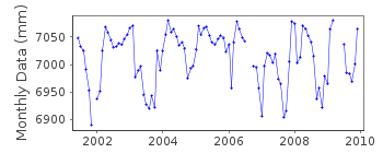
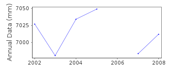
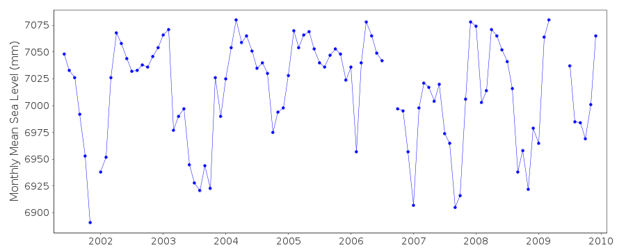
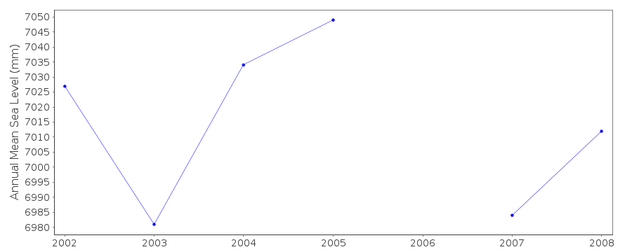
Tide Gauge Data
Station Documentation
Link to RLR information.Documentation added 2010-06-28
Amasra station is on the Black Sea and is part of the Turkish Sea LevelMonitoring Network. Previous Coast/Station code 310/026. Id=1919. Total dataset
revised by the authority. Station was made RLR. RLR(2008) is 8.000m below TGBM
AMSR-1.
RLR factor is 4836m.
Data Authority
General Directorate of MappingTlp Fakultesi Cad
06590 Cebeci/Cankaya
Ankara

![]()
![]()
![]()
