Data
- Obtaining
- Supplying
- High-Frequency
- Bottom Pressure Records
- Other Long Records
- GLOSS/ODINAFRICA Calibration Data
Donate
Donate to PSMSL
Data Notes
- Individual Station Data and Plot Notes
- Referencing the Data Set
- PSMSL Help File
- 2010 Changes to the PSMSL Data Files
Extracted from Database
03 Mar 2025
Station Information
| Station ID: | 2123 |
| Latitude: | 28.415 |
| Longitude: | -80.591667 |
| Coastline code: | 960 |
| Station code: | 15 |
| Country: | UNITED STATES |
| Time span of data: | 1994 – 2024 |
| Completeness (%): | 97 |
| Date of last update: | 23 Jan 2025 |
| Green Arrow: | Current Station |
| Yellow Marker: | Neighbouring RLR Station |
| Red Marker: | Neighbouring Metric Station |
Please note: In many cases, the station position in our database is accurate to only one minute. Thus, the tide gauge may not appear to be on the coast.
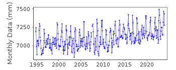
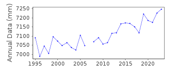
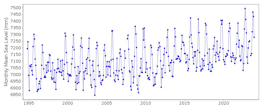
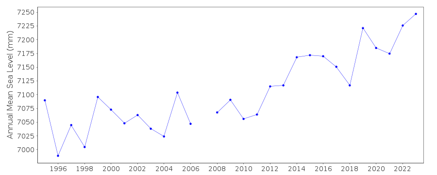
Tide Gauge Data
Additional Data Sources (guide to additional data sources)
Nearby GNSS Stations from SONEL: CCV6, CCV4Research Quality Data from UHSLC station 774: hourly and daily
Research Quality Data from UHSLC station 754: hourly and daily
Station Documentation
Link to RLR information.Documentation added 2012-01-23
Trident Pier, Port Canaveral is a new station, data and metadata were downloaded from NOAA. Primary benchmark is 1604 A 1994 9.303m above TGZ. Station made RLR with RLR factor 0.997m.Data Authority
N.O.A.A. / N.O.S.N/oes33, Ssmc4, Room 6531
1305 East-West Highway
Silver Spring,
MD 20910

![]()
![]()
![]()
