Data
- Obtaining
- Supplying
- High-Frequency
- Bottom Pressure Records
- Other Long Records
- GLOSS/ODINAFRICA Calibration Data
Donate
Donate to PSMSL
Data Notes
- Individual Station Data and Plot Notes
- Referencing the Data Set
- PSMSL Help File
- 2010 Changes to the PSMSL Data Files
Extracted from Database
03 Mar 2025
Station Information
| Station ID: | 2151 |
| Latitude: | 10.516667 |
| Longitude: | 122.8 |
| Coastline code: | 660 |
| Station code: | 5 |
| Country: | PHILIPPINES |
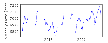
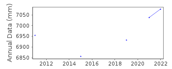
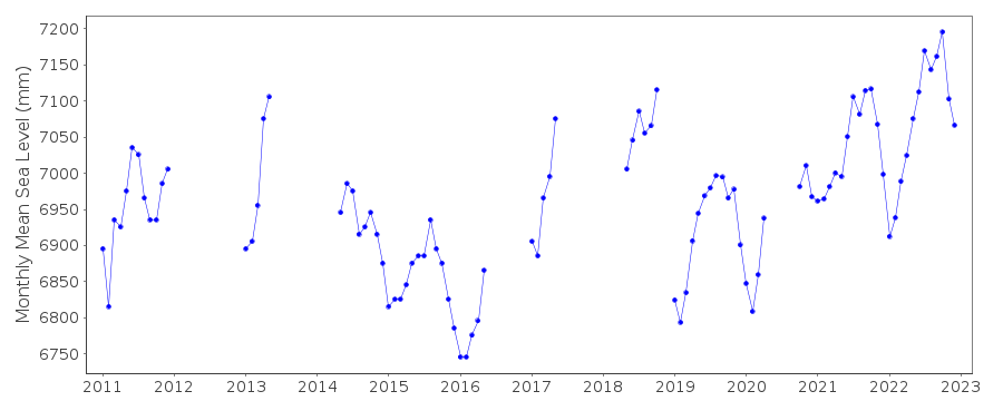
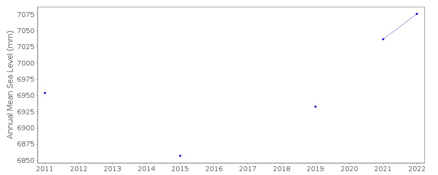
| Time span of data: | 2011 – 2023 |
| Completeness (%): | 69 |
| Date of last update: | 08 Jul 2024 |
| Green Arrow: | Current Station |
| Yellow Marker: | Neighbouring RLR Station |
| Red Marker: | Neighbouring Metric Station |
Please note: In many cases, the station position in our database is accurate to only one minute. Thus, the tide gauge may not appear to be on the coast.
Tide Gauge Data
Station Documentation
Link to RLR information.Documentation added 2012-12-11
Pulupandan, Negros Occidentalis a newly supplied station. Primary benchmark is BM 34.304m above Datum 2008. Gauge type STEVENS AXSYS
Data Authority
National Mapping and Resource Information AuthorityHydrography Department
421 Barraca St,
San Nicolas 1010
Manila

![]()
![]()
![]()
