Data
- Obtaining
- Supplying
- High-Frequency
- Bottom Pressure Records
- Other Long Records
- GLOSS/ODINAFRICA Calibration Data
Donate
Donate to PSMSL
Data Notes
- Individual Station Data and Plot Notes
- Referencing the Data Set
- PSMSL Help File
- 2010 Changes to the PSMSL Data Files
Extracted from Database
11 Mar 2024
Station Information
| Station ID: | 2244 |
| Latitude: | -14.296023 |
| Longitude: | -178.160225 |
| GLOSS ID: | 353 |
| Coastline code: | 743 |
| Station code: | 1 |
| Country: | WALLIS AND FUTUNA |
| Time span of data: | 1986 – 2019 |
| Completeness (%): | 19 |
| Link to ellipsoid: | Available |
| Date of last update: | 10 Nov 2020 |
| Green Arrow: | Current Station |
| Yellow Marker: | Neighbouring RLR Station |
| Red Marker: | Neighbouring Metric Station |
Please note: In many cases, the station position in our database is accurate to only one minute. Thus, the tide gauge may not appear to be on the coast.
Tide Gauge Data
Additional Data Sources (guide to additional data sources)
Nearby GNSS Stations from SONEL: FTNA, FTTGNearby Real Time Stations from VLIZ: futu
Fast Delivery Data from UHSLC station 453: hourly and daily
Station Documentation
Link to RLR information.Documentation added 2016-06-21
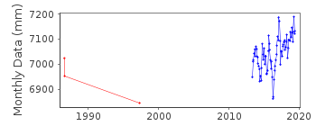
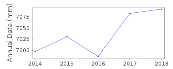
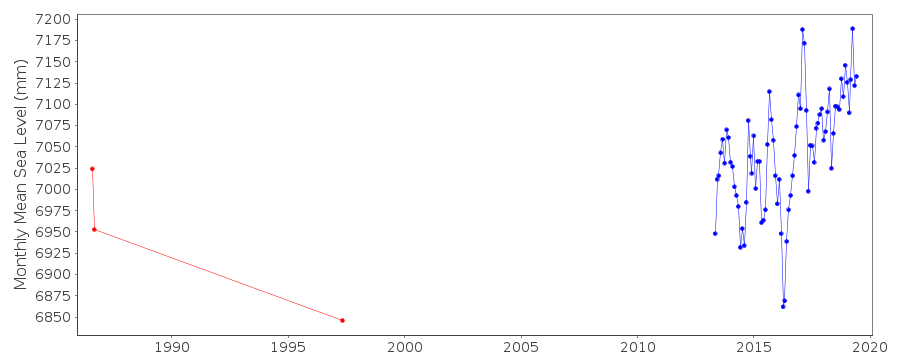
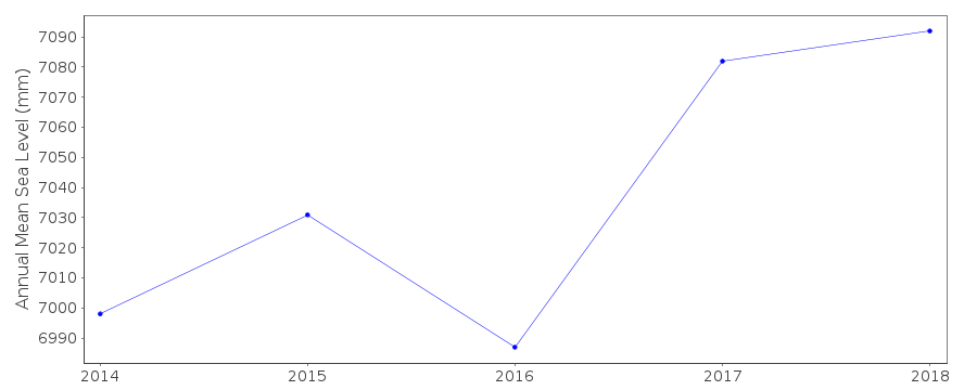
Data for Leava on the Wallis and Futuna Island has only recently been added to the database. There are very short periods of data for August-September 1986, May 1997 and then from May 2013 onwards.Documentation added 2019-08-07
Using station information from the SHOM website the station has been made RLR. However, instead of a Benchmark name there is a description of the tide gauge. Because of this the Benchmark name has been entered on the RLR diagram TGBM.Data Authority
SHOM13 rue de Chatelier
29200 BREST

![]()
![]()
![]()
