Data
- Obtaining
- Supplying
- High-Frequency
- Bottom Pressure Records
- Other Long Records
- GLOSS/ODINAFRICA Calibration Data
Donate
Donate to PSMSL
Data Notes
- Individual Station Data and Plot Notes
- Referencing the Data Set
- PSMSL Help File
- 2010 Changes to the PSMSL Data Files
Extracted from Database
03 Mar 2025
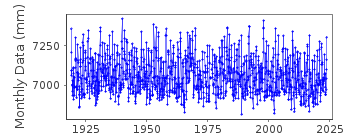
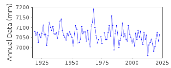
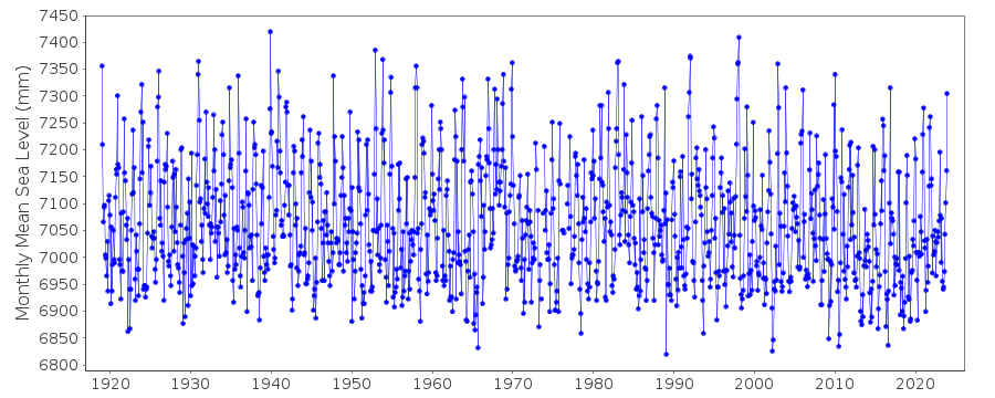
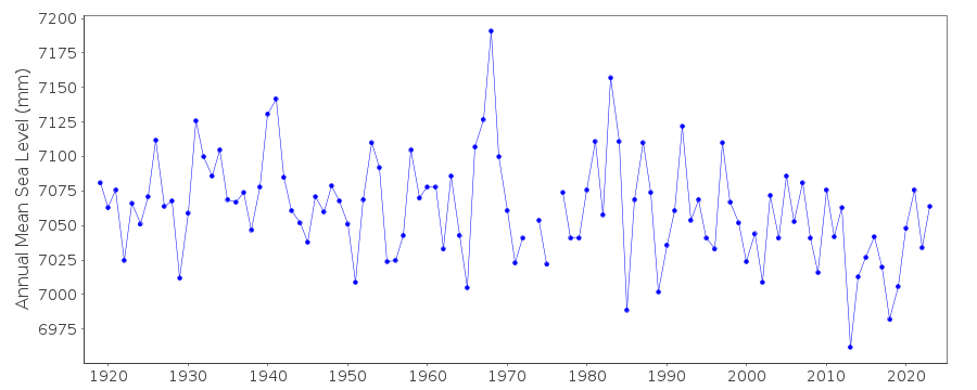
Station Information
| Station ID: | 225 |
| Latitude: | 55.331667 |
| Longitude: | -131.625 |
| Coastline code: | 821 |
| Station code: | 51 |
| Country: | UNITED STATES |
| Time span of data: | 1919 – 2024 |
| Completeness (%): | 99 |
| Date of last update: | 23 Jan 2025 |
| Green Arrow: | Current Station |
| Yellow Marker: | Neighbouring RLR Station |
| Red Marker: | Neighbouring Metric Station |
Please note: In many cases, the station position in our database is accurate to only one minute. Thus, the tide gauge may not appear to be on the coast.
Tide Gauge Data
Additional Data Sources (guide to additional data sources)
Fast Delivery Data from UHSLC station 571: hourly and dailyResearch Quality Data from UHSLC station 571: hourly and daily
Station Documentation
Link to RLR information.Documentation added 1991-06-11
Ketchikan 821/051 RLR(1964) is 10.2m below BM22Documentation added 1992-04-02
South Alaskan coastline earthquake prone - e.g. magnitude 9.2 earthquake of 28 March 1964 - See Savage and Plafker, JGR, 96(B3), 4325-4335, 1991Data Authority
N.O.A.A. / N.O.S.N/oes33, Ssmc4, Room 6531
1305 East-West Highway
Silver Spring,
MD 20910

![]()
![]()
![]()
