Data
- Obtaining
- Supplying
- High-Frequency
- Bottom Pressure Records
- Other Long Records
- GLOSS/ODINAFRICA Calibration Data
Donate
Donate to PSMSL
Data Notes
- Individual Station Data and Plot Notes
- Referencing the Data Set
- PSMSL Help File
- 2010 Changes to the PSMSL Data Files
Extracted from Database
13 Jul 2026
Station Information
| Station ID: | 2267 |
| Latitude: | 13.775 |
| Longitude: | 109.255 |
| GLOSS ID: | 75 |
| Coastline code: | 605 |
| Station code: | 42 |
| Country: | VIET NAM |
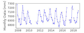
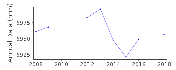
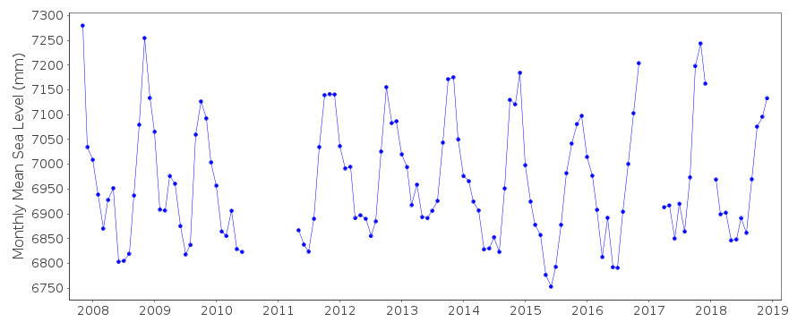
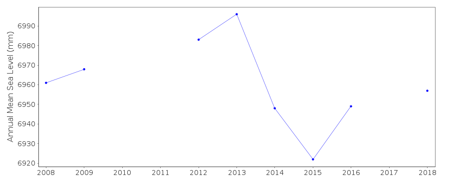
| Time span of data: | 2007 – 2018 |
| Completeness (%): | 83 |
| Date of last update: | 29 Jan 2020 |
| Green Arrow: | Current Station |
| Yellow Marker: | Neighbouring RLR Station |
| Red Marker: | Neighbouring Metric Station |
Please note: In many cases, the station position in our database is accurate to only one minute. Thus, the tide gauge may not appear to be on the coast.
Tide Gauge Data
Additional Data Sources (guide to additional data sources)
Nearby Real Time Stations from VLIZ: quinFast Delivery Data from UHSLC station 381: hourly and daily
Research Quality Data from UHSLC station 381: hourly and daily
Station Documentation
Link to RLR information.Documentation added 2015-09-29
Qui Nhon II is a new station data has been supplied by UHSLC. Using information from the UHSLC levelling sheet Qui Nhon II has been made RLR. Primary benchmark is KTTV which is 5.166m above the datum.Documentation added 2015-11-04
Complete updated JASL dataset 2007-2014 loaded onto the database.Data Authority
University of Hawaii Sea Level CenterDepartment of Oceanography Division of Natural Sciences
1000 Pope Road
Honolulu
Hawaii 96822

![]()
![]()
![]()
