Data
- Obtaining
- Supplying
- High-Frequency
- Bottom Pressure Records
- Other Long Records
- GLOSS/ODINAFRICA Calibration Data
Donate
Donate to PSMSL
Data Notes
- Individual Station Data and Plot Notes
- Referencing the Data Set
- PSMSL Help File
- 2010 Changes to the PSMSL Data Files
Extracted from Database
03 Mar 2025
Station Information
| Station ID: | 2308 |
| Latitude: | 43.34653 |
| Longitude: | -8.53012 |
| Coastline code: | 200 |
| Station code: | 33 |
| Country: | SPAIN |
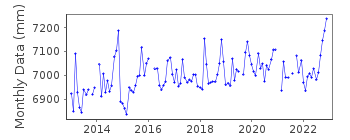
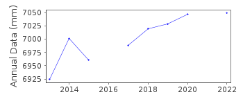
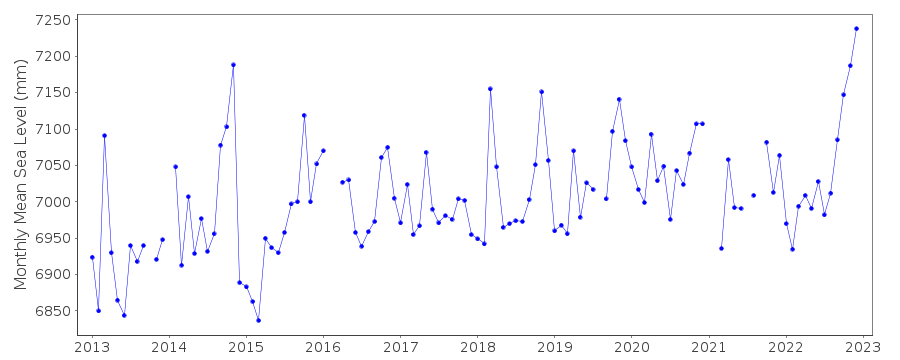
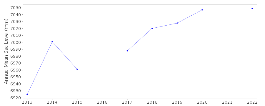
| Time span of data: | 2013 – 2022 |
| Completeness (%): | 93 |
| Date of last update: | 11 Jul 2023 |
| Green Arrow: | Current Station |
| Yellow Marker: | Neighbouring RLR Station |
| Red Marker: | Neighbouring Metric Station |
Please note: In many cases, the station position in our database is accurate to only one minute. Thus, the tide gauge may not appear to be on the coast.
Tide Gauge Data
Additional Data Sources (guide to additional data sources)
Nearby GNSS Stations from SONEL: LNGSNearby Real Time Stations from VLIZ: lang
Station Documentation
Link to RLR information.Documentation added 2016-07-28
Langosteira is a new REDMAR station.Documentation added 2023-07-11
There was local subsidence of the quay in 2022 - corrected values will be providedData Authority
Puertos del EstadoÁrea de Conocimiento y Análisis del Medio Físico
Avda. Del Partenón, 10
28042, Madrid
Documentation added 2001-03-06
The Area de Conocimiento y Analisis del Medio Fisico wasformerly known as the Departamento de Clima Maritimo.

![]()
![]()
![]()
