Data
- Obtaining
- Supplying
- High-Frequency
- Bottom Pressure Records
- Other Long Records
- GLOSS/ODINAFRICA Calibration Data
Donate
Donate to PSMSL
Data Notes
- Individual Station Data and Plot Notes
- Referencing the Data Set
- PSMSL Help File
- 2010 Changes to the PSMSL Data Files
Extracted from Database
03 Mar 2025
Station Information
| Station ID: | 2310 |
| Latitude: | -28.536811 |
| Longitude: | 153.552111 |
| Coastline code: | 680 |
| Station code: | 82 |
| Country: | AUSTRALIA |
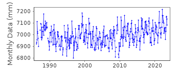
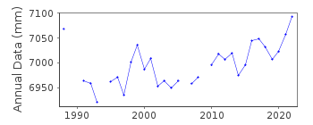
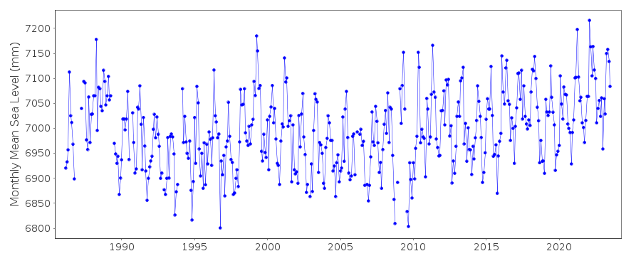
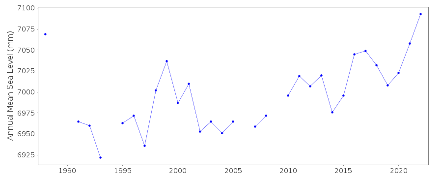
| Time span of data: | 1986 – 2023 |
| Completeness (%): | 94 |
| Date of last update: | 21 Feb 2024 |
| Green Arrow: | Current Station |
| Yellow Marker: | Neighbouring RLR Station |
| Red Marker: | Neighbouring Metric Station |
Please note: In many cases, the station position in our database is accurate to only one minute. Thus, the tide gauge may not appear to be on the coast.
Tide Gauge Data
Station Documentation
Link to RLR information.Documentation added 2016-08-04
Brunswick Heads is a new station data supplied by the NSW Public Works, Manly Hydraulics Laboratory (MHL). Using information supplied by MHL this station has been made RLR Primary benchmark is BM 1/DL 2.294m above Brunswick River Flood Mitigation Datum.Sensor is a pressure sensor.
Data General Release Conditions
The data provided is supplied subject to the following conditions:
© Crown in right of New South Wales
The data supplied is licensed under a Creative Commons Attribution 4.0 licence.
To view a copy of this licence visit: http://creativecommons.org/licenses/by/4.0 and
http://creativecommons.org/licenses/by/4.0/legalcode
You are free to copy distribute display and perform the work, to make derivative works and to make commercial use of the work under the following conditions attributing the data to "NSW Office of Environment and Heritage" in any publications.
Data Authority
Manly Hydraulics Laboratory110B King Street
Manly Vale
NSW 2093

![]()
![]()
![]()
