Data
- Obtaining
- Supplying
- High-Frequency
- Bottom Pressure Records
- Other Long Records
- GLOSS/ODINAFRICA Calibration Data
Donate
Donate to PSMSL
Data Notes
- Individual Station Data and Plot Notes
- Referencing the Data Set
- PSMSL Help File
- 2010 Changes to the PSMSL Data Files
Extracted from Database
22 Jun 2026
Station Information
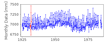
| Station ID: | 269 |
| Latitude: | 22.2 |
| Longitude: | 113.55 |
| Coastline code: | 609 |
| Station code: | 1 |
| Country: | MACAO |
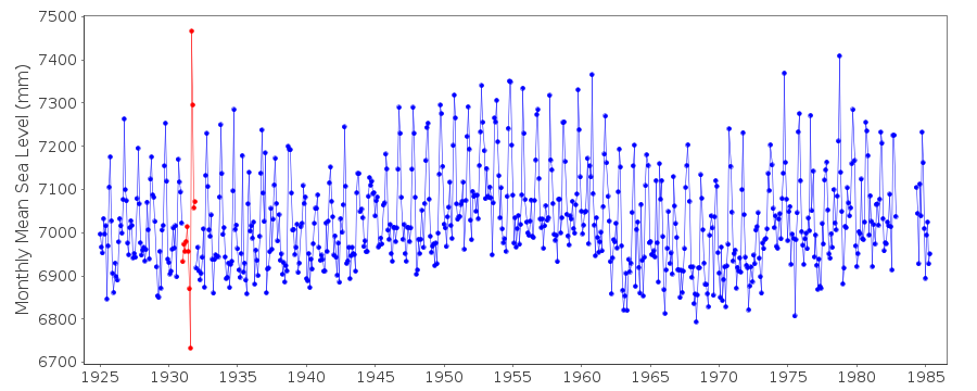
| Time span of data: | 1925 – 1985 |
| Completeness (%): | 97 |
| Date of last update: | 06 Sep 1990 |
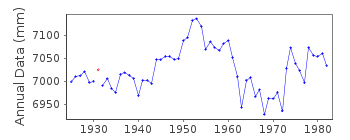
| Green Arrow: | Current Station |
| Yellow Marker: | Neighbouring RLR Station |
| Red Marker: | Neighbouring Metric Station |
Please note: In many cases, the station position in our database is accurate to only one minute. Thus, the tide gauge may not appear to be on the coast.
Tide Gauge Data
Additional Data Sources (guide to additional data sources)
Nearby GNSS Stations from SONEL: FOMOResearch Quality Data from UHSLC station 338: hourly and daily
Station Documentation
Link to RLR information.Documentation - date unknown
GAUGE RE SITED IN 1984Documentation added 1991-06-11
Macau 609/001 RLR(1967) is 9.7m below BMIIDocumentation added 1993-07-12
Macau 609/001 RLR(1967) is 9.7m below BMIIDocumentation added 1993-07-29
Anmalously low value September 1931 followed by anomalously highvalue in October 1931.
Macau is an historic station last data 1985
Data Authority
Hydrographic InstituteRua das Trinas 49
1249-093 Lisboa

![]()
![]()
![]()
