Data
- Obtaining
- Supplying
- High-Frequency
- Bottom Pressure Records
- Other Long Records
- GLOSS/ODINAFRICA Calibration Data
Donate
Donate to PSMSL
Data Notes
- Individual Station Data and Plot Notes
- Referencing the Data Set
- PSMSL Help File
- 2010 Changes to the PSMSL Data Files
Extracted from Database
03 Mar 2025
Station Information
| Station ID: | 331 |
| Latitude: | 4.884556 |
| Longitude: | -1.745028 |
| GLOSS ID: | 335 |
| Coastline code: | 410 |
| Station code: | 1 |
| Country: | GHANA |
| Time span of data: | 1929 – 2012 |
| Completeness (%): | 79 |
| Date of last update: | 15 Mar 2013 |
| Green Arrow: | Current Station |
| Yellow Marker: | Neighbouring RLR Station |
| Red Marker: | Neighbouring Metric Station |
Please note: In many cases, the station position in our database is accurate to only one minute. Thus, the tide gauge may not appear to be on the coast.
Tide Gauge Data
Additional Data Sources (guide to additional data sources)
Nearby Real Time Stations from VLIZ: tkdiFast Delivery Data from UHSLC station 231: hourly and daily
Research Quality Data from UHSLC station 231: hourly and daily
Station Documentation
Link to RLR information.Documentation - date unknown
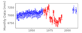
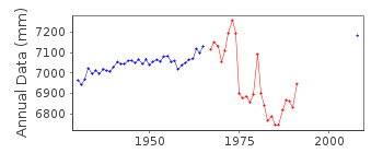
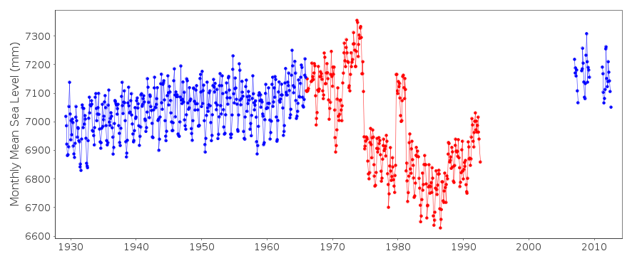
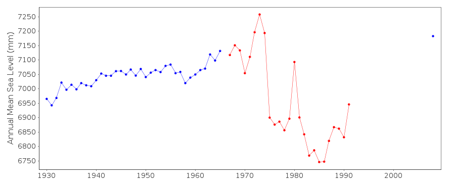
DATA FROM 1966 ONWARDS LOOKS IRREGULAR AND UNRELIABLEDocumentation added 1991-06-11
Takoradi 410/001 RLR(1970) is 9.2m below BM GCSH4Documentation added 1995-11-01
Gauge type is a Baldwin Lathanis, installed in 1926 1992-95 problems with gauge reportedDocumentation added 1996-06-03
Gauge reported on 17 January 1996 as not operational because of its age.Documentation added 2009-03-10
2007/8 one minute sea level data downloaded from the IOC Sea Level Station Monitoring Facility Ostend. This is then converted to 15min. data for processing. 2007/8 monthly and annual mean sea level values have now been extrapolated from the data. As the relationship for the prime bench mark remains the same there is no need to alter RLR. Details of the bench marks has been derived from site installation information. Copies of these have been included in the port files and RLR file for reference.Data Authority
Survey and Mapping DivisionP.O. Box CT 903
Cantonments
Accra

![]()
![]()
![]()
