Data
- Obtaining
- Supplying
- High-Frequency
- Bottom Pressure Records
- Other Long Records
- GLOSS/ODINAFRICA Calibration Data
Donate
Donate to PSMSL
Data Notes
- Individual Station Data and Plot Notes
- Referencing the Data Set
- PSMSL Help File
- 2010 Changes to the PSMSL Data Files
Extracted from Database
03 Mar 2025
Station Information
| Station ID: | 513 |
| Latitude: | 8.731667 |
| Longitude: | 167.735 |
| GLOSS ID: | 111 |
| Coastline code: | 720 |
| Station code: | 11 |
| Country: | MARSHALL ISLANDS |
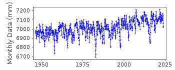
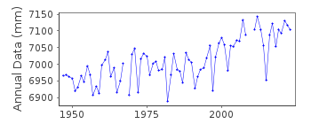
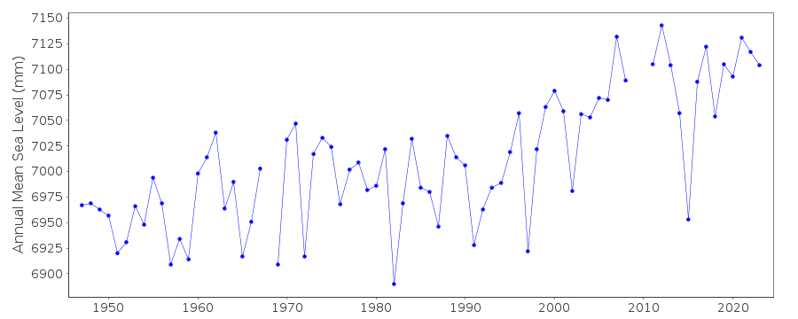
| Time span of data: | 1946 – 2023 |
| Completeness (%): | 98 |
| Date of last update: | 26 Jan 2024 |
| Green Arrow: | Current Station |
| Yellow Marker: | Neighbouring RLR Station |
| Red Marker: | Neighbouring Metric Station |
Please note: In many cases, the station position in our database is accurate to only one minute. Thus, the tide gauge may not appear to be on the coast.
Tide Gauge Data
Additional Data Sources (guide to additional data sources)
Nearby GNSS Stations from SONEL: KWJ1Nearby Real Time Stations from VLIZ: kwaj, kwaj2
Fast Delivery Data from UHSLC station 55: hourly and daily
Research Quality Data from UHSLC station 55: hourly and daily
Station Documentation
Link to RLR information.Documentation added 1991-06-11
Kwajalein 720/011 RLR(1964) is 8.6m below BMADocumentation added 2011-11-23
Using information from the NOAA website the RLR diagram has been revised. Previous Primary BM A no longer appears in the NOAA report. Primary benchmark is NO 8 1951 2.853m above gauge datum. This benchmark has been added to the original diagram as a secondary benchmark.Documentation added 2019-02-05
Entire dataset for Kwajalein as a large number of the early data values have been revised.Data Authority
N.O.A.A. / N.O.S.N/oes33, Ssmc4, Room 6531
1305 East-West Highway
Silver Spring,
MD 20910

![]()
![]()
![]()
