Data
- Obtaining
- Supplying
- High-Frequency
- Bottom Pressure Records
- Other Long Records
- GLOSS/ODINAFRICA Calibration Data
Donate
Donate to PSMSL
Data Notes
- Individual Station Data and Plot Notes
- Referencing the Data Set
- PSMSL Help File
- 2010 Changes to the PSMSL Data Files
Extracted from Database
03 Mar 2025
WARNING: QCFLAG EXISTS. PLEASE READ THE DOCUMENTATION.
Station Information
| Station ID: | 590 |
| Latitude: | 28.136327 |
| Longitude: | -15.425688 |
| GLOSS ID: | 251 |
| Coastline code: | 370 |
| Station code: | 41 |
| Country: | SPAIN |
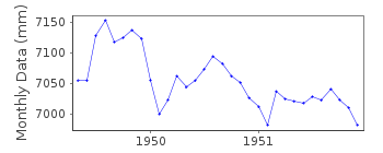
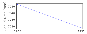
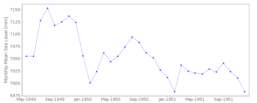
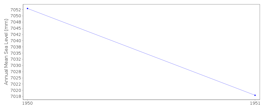
| Time span of RLR data: | 1949 – 1951 |
| RLR completeness (%): | 89 |
| Time span of metric data: | 1949 – 1955 |
| Metric completeness (%): | 89 |
| Link to ellipsoid: | Available |
| Date of last update: | 25 Nov 1993 |
| Green Arrow: | Current Station |
| Yellow Marker: | Neighbouring RLR Station |
| Red Marker: | Neighbouring Metric Station |
Please note: In many cases, the station position in our database is accurate to only one minute. Thus, the tide gauge may not appear to be on the coast.
Tide Gauge Data
Additional Data Sources (guide to additional data sources)
Nearby GNSS Stations from SONEL: PLUZ, ULP2Nearby Real Time Stations from VLIZ: lasp
Fast Delivery Data from UHSLC station 217: hourly and daily
Research Quality Data from UHSLC station 217: hourly and daily
Station Documentation
Link to RLR information.Documentation - date unknown
No BM information but data seems homogenousDocumentation added 1991-06-11
Puerto De La Luz 370/041 RLR(1951) is 8.2m below BMDocumentation added 1993-07-12
Short record with a large negative trend.Documentation added 1993-11-12
Data 1952-55 received from TOGA officeData Authority
Instituto Español de OceanografíaCorazón de María, 8
28002, Madrid

![]()
![]()
![]()
