Data
- Obtaining
- Supplying
- High-Frequency
- Bottom Pressure Records
- Other Long Records
- GLOSS/ODINAFRICA Calibration Data
Donate
Donate to PSMSL
Data Notes
- Individual Station Data and Plot Notes
- Referencing the Data Set
- PSMSL Help File
- 2010 Changes to the PSMSL Data Files
Extracted from Database
03 Mar 2025
Station Information
| Station ID: | 66 |
| Latitude: | 51.7 |
| Longitude: | -5.016667 |
| Coastline code: | 170 |
| Station code: | 181 |
| Country: | UNITED KINGDOM |
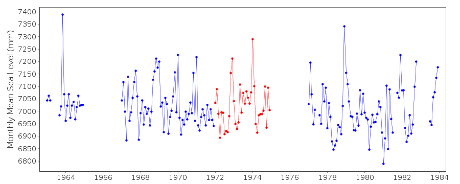
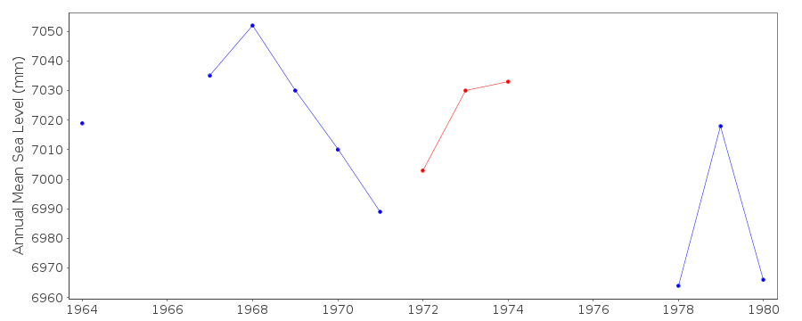
| Time span of RLR data: | 1963 – 1983 |
| RLR completeness (%): | 74 |
| Time span of metric data: | 1886 – 1983 |
| Metric completeness (%): | 33 |
| Date of last update: | 20 Feb 1987 |
| Green Arrow: | Current Station |
| Yellow Marker: | Neighbouring RLR Station |
| Red Marker: | Neighbouring Metric Station |
Please note: In many cases, the station position in our database is accurate to only one minute. Thus, the tide gauge may not appear to be on the coast.
Tide Gauge Data
Additional Data Sources (guide to additional data sources)
Nearby Real Time Stations from VLIZ: mhavStation Documentation
Link to RLR information.Documentation added 1991-06-11
Milford Haven 170/181 RLR(1967) is 14.6m below BM SM9183 0494Documentation added 1993-07-12
Milford Haven 170/181 RLR(1967) is 14.6m below BM SM9183 0494Documentation added 1993-10-11
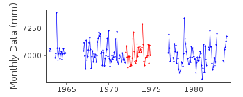
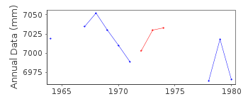
1972-74 DATA OF POOR QUALITYDocumentation added 1994-07-20
No gauge details are known prior to 1950. Between 1950 andFebruary 1966 the gauge was a Cary-Porter stilling well system,
replaced in the same hut by a Munro in June 1967 until May 1984.
Milford Haven (Newton Noyes) is an historic station last data 1983
Documentation added 2001-01-02
Recent work on vertical land movements in the UK can be found fromthe University of Nottingham web site:
http://ukcogr.iessg.nottingham.ac.uk/~eosi/
1975 AND 1976 DATA SUSPECT - POSSIBLY DUE TO SILT
Data Authority
United Kingdom Hydrographic OfficeAdmiralty Way
Taunton
Somerset
TA1 2DN

![]()
![]()
![]()
