Data
- Obtaining
- Supplying
- High-Frequency
- Bottom Pressure Records
- Other Long Records
- GLOSS/ODINAFRICA Calibration Data
Donate
Donate to PSMSL
Data Notes
- Individual Station Data and Plot Notes
- Referencing the Data Set
- PSMSL Help File
- 2010 Changes to the PSMSL Data Files
Extracted from Database
06 Apr 2026
Station Information
| Station ID: | 886 |
| Latitude: | 32.366667 |
| Longitude: | -64.666667 |
| Coastline code: | 950 |
| Station code: | 1 |
| Country: | BERMUDA |
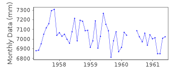
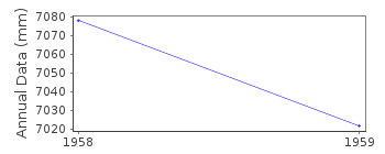
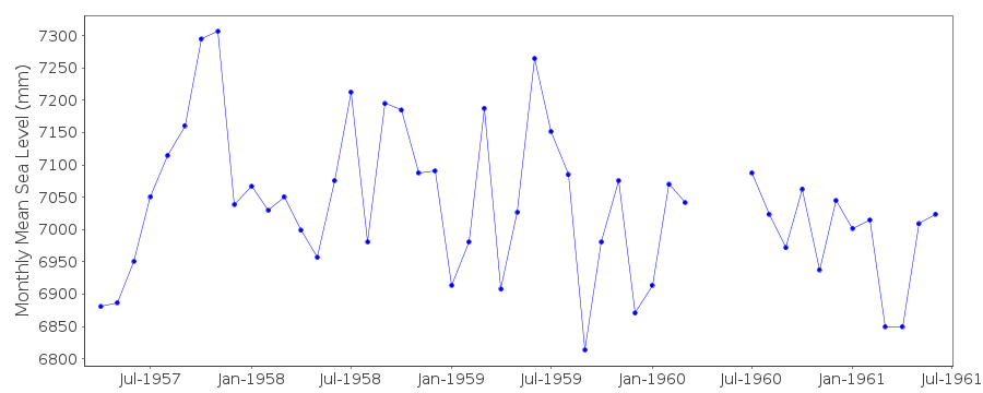
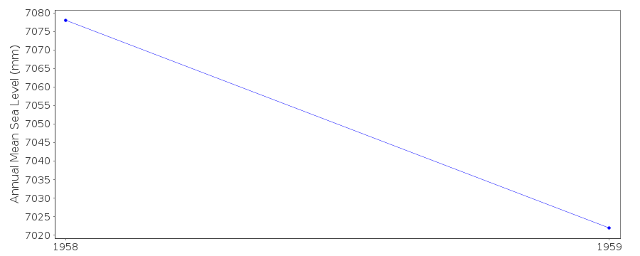
| Time span of data: | 1957 – 1961 |
| Completeness (%): | 80 |
| Date of last update: | 01 Jan 1980 |
| Green Arrow: | Current Station |
| Yellow Marker: | Neighbouring RLR Station |
| Red Marker: | Neighbouring Metric Station |
Please note: In many cases, the station position in our database is accurate to only one minute. Thus, the tide gauge may not appear to be on the coast.
Tide Gauge Data
Additional Data Sources (guide to additional data sources)
Nearby Real Time Stations from VLIZ: bmda, bbst2, bbstFast Delivery Data from UHSLC station 259: hourly and daily
Research Quality Data from UHSLC station 259: hourly and daily
Station Documentation
Link to RLR information.Documentation added 1991-06-11
Paget Island 950/001 RLR(1959) is 9.1m below BM1Documentation added 2012-02-15
Paget Island is an Historic station. Last data received was that for 1961. Thisstation no longer appears in the NOAA documentation.
Data Authority
Lamont Geological ObservatoryColumbia University
Palisades
New York 10964

![]()
![]()
![]()
