Data
- Obtaining
- Supplying
- High-Frequency
- Bottom Pressure Records
- Other Long Records
- GLOSS/ODINAFRICA Calibration Data
Donate
Donate to PSMSL
Data Notes
- Individual Station Data and Plot Notes
- Referencing the Data Set
- PSMSL Help File
- 2010 Changes to the PSMSL Data Files
Extracted from Database
03 Mar 2025
Station Information
| Station ID: | 89 |
| Latitude: | 57.595556 |
| Longitude: | 9.963889 |
| Coastline code: | 130 |
| Station code: | 101 |
| Country: | DENMARK |
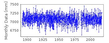
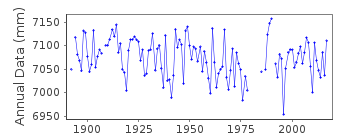
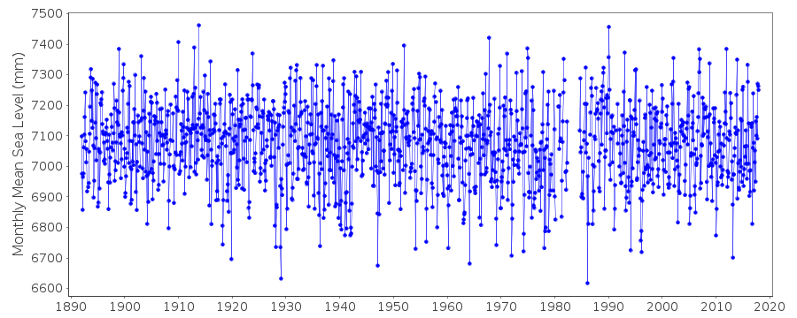
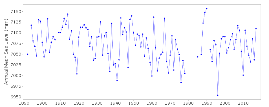
| Time span of data: | 1892 – 2017 |
| Completeness (%): | 96 |
| Date of last update: | 27 Nov 2018 |
| Green Arrow: | Current Station |
| Yellow Marker: | Neighbouring RLR Station |
| Red Marker: | Neighbouring Metric Station |
Please note: In many cases, the station position in our database is accurate to only one minute. Thus, the tide gauge may not appear to be on the coast.
Tide Gauge Data
Additional Data Sources (guide to additional data sources)
Nearby GNSS Stations from SONEL: HIRSNearby Real Time Stations from VLIZ: hirt
Station Documentation
Link to RLR information.Documentation added 1991-06-11
Hirtshals 130/101 RLR(1964) is 17.0m below BMGM893,1Documentation added 1992-07-07
Prior to 1991 fcode=24Documentation added 2008-02-11
Previously held data for 2000-2002 revised using values supplied by DMI. Data for 2003-2006 also supplied.Documentation added 2012-10-03
Information from DMI confirms Primary benchmark is 54-05-9059 8.578m above TGZ.Documentation added 2013-09-12
The PSMSL has received a copy of the Technical Report 13-15 'Sea level data 1889-2012 from 14 stations in Denmark Mean, maximum and minimum values calculated on monthly and yearly basis including plots of mean values' from the DMI. As a result of the exercise data values for Hirtshals 1971-2012 have been revised. These revised data values have been entered onto the database.Documentation added 2018-11-28
Following the receipt of the DMI Report 18-16 supplied with data spanning 1889-2017 from 14 Danish stations the data for 2010-2012 has been revised due to a few erroneous values and new updated levellings.Data Authority
Det Danske Meteorologiske InstitutObservation Department, Operations Division
Lyngbyvej 100
DK-2100 Kobenhavn

![]()
![]()
![]()
