Data
- Obtaining
- Supplying
- High-Frequency
- Bottom Pressure Records
- Other Long Records
- GLOSS/ODINAFRICA Calibration Data
Donate
Donate to PSMSL
Data Notes
- Individual Station Data and Plot Notes
- Referencing the Data Set
- PSMSL Help File
- 2010 Changes to the PSMSL Data Files
Extracted from Database
21 Apr 2025
Station Information
| Station ID: | 985 |
| Latitude: | 36.5401 |
| Longitude: | -6.2862 |
| Coastline code: | 220 |
| Station code: | 3 |
| Country: | SPAIN |
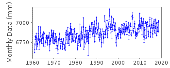
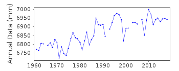
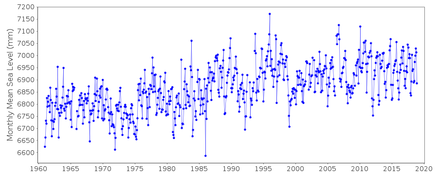
| Time span of data: | 1961 – 2018 |
| Completeness (%): | 97 |
| Date of last update: | 14 Mar 2019 |
| Green Arrow: | Current Station |
| Yellow Marker: | Neighbouring RLR Station |
| Red Marker: | Neighbouring Metric Station |
Please note: In many cases, the station position in our database is accurate to only one minute. Thus, the tide gauge may not appear to be on the coast.
Tide Gauge Data
Additional Data Sources (guide to additional data sources)
Nearby GNSS Stations from SONEL: SFER, ROAG, ROAPStation Documentation
Link to RLR information.Documentation added 2000-04-25
Cadiz III 220/003 RLR(1997) is 10.3m below BM NAPG-479Documentation added 2001-01-12
Data for 1961-99 revisedDocumentation added 2008-12-11
Database updated with a revised dataset supplied byMaria Jesus. Previous values copied and stored in the file.
Documentation added 2014-09-03
Using values from a listing recently supplied by IEO the co-ordinates for Cadiz have been revised.Data Authority
Instituto Español de OceanografíaCorazón de María, 8
28002, Madrid

![]()
![]()
![]()
