Information
| ID: | 10019 |
| IGS type code: | TGW200DEU |
| Latitude: | 53.806315° |
| Longitude: | 7.929231° |
| Ellipsoidal Height: | 51.748 m |
| Ellipsoidal Height Epoch: | 2021.0000 |
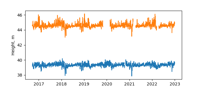
| Reflector Height: | 12.354 m |
| Provider: | BAFG |
| Alternative Providers: | |
| SONEL Link: | |
| NGL Link: | TGWN |
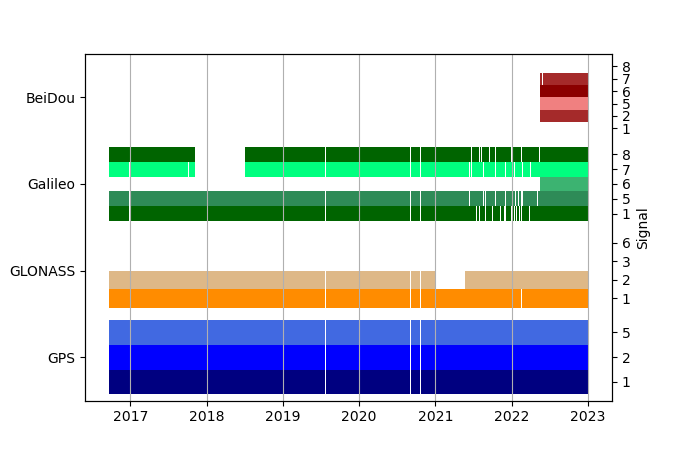
| GNSS Receiver | |
| Mask used |
Data
Zipped data filePlot of daily data
Inventory
Additional Data Sources from tide gauges (guide to additional data sources)


