Information
| ID: | 10050 |
| IGS type code: | NSLG00GBR |
| Latitude: | 55.008910° |
| Longitude: | -1.432570° |
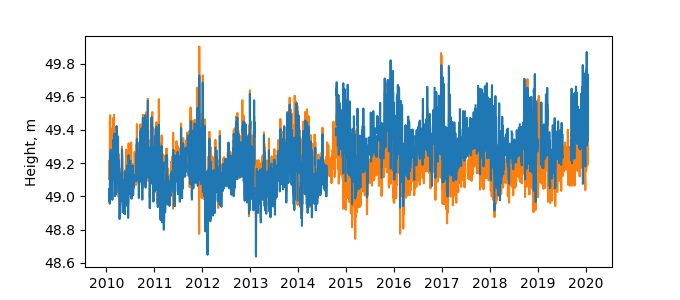
| Ellipsoidal Height: | 55.952 m |
| Ellipsoidal Height Epoch: | 2015.0000 |
| Reflector Height: | 6.866 m |
| Provider: | BIGF |
| Alternative Providers: | SONEL |
| SONEL Link: | NSLG00GBR |
| NGL Link: |
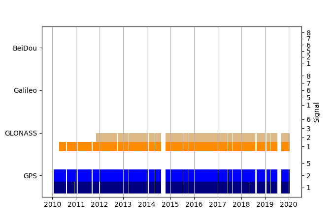
| GNSS Receiver | |
| Mask used |
Data
Zipped data filePlot of daily data
Inventory
Additional Data Sources from tide gauges (guide to additional data sources)
Monthly Mean Data from PSMSL: 95Nearby Real Time Stations from VLIZ: nshi


