Information
| ID: | 10051 |
| IGS type code: | PBIL00GBR |
| Latitude: | 50.521780° |
| Longitude: | -2.457490° |
| Ellipsoidal Height: | 107.446 m |
| Ellipsoidal Height Epoch: | 2020.0000 |
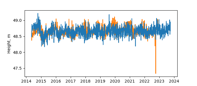
| Reflector Height: | 58.936 m |
| Provider: | BIGF |
| Alternative Providers: | |
| SONEL Link: | PBIL00GBR |
| NGL Link: |
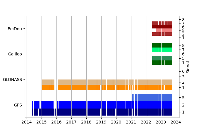
| GNSS Receiver | |
| Mask used |
Data
Zipped data filePlot of daily data
Inventory
Additional Data Sources from tide gauges (guide to additional data sources)
Nearby Real Time Stations from VLIZ: weym

