Information
| ID: | 10056 |
| IGS type code: | PADT00GBR |
| Latitude: | 50.541112° |
| Longitude: | -4.936786° |
| Ellipsoidal Height: | 65.430 m |
| Ellipsoidal Height Epoch: | 2020.0000 |
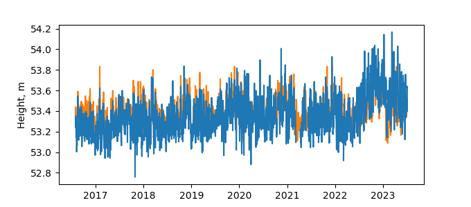
| Reflector Height: | 12.186 m |
| Provider: | BIGF |
| Alternative Providers: | |
| SONEL Link: | PADT00GBR |
| NGL Link: |
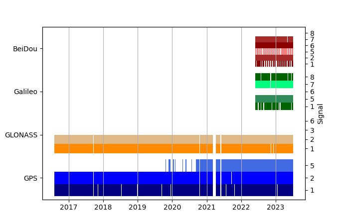
| GNSS Receiver | |
| Mask used |
Data
Zipped data filePlot of daily data
Inventory
Additional Data Sources from tide gauges (guide to additional data sources)


