Information
| ID: | 10060 |
| IGS type code: | OHI300ATA |
| Latitude: | -63.321092° |
| Longitude: | -57.901384° |
| Ellipsoidal Height: | 32.694 m |
| Ellipsoidal Height Epoch: | 2017.0000 |
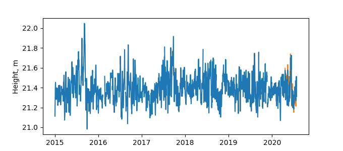
| Reflector Height: | 11.452 m |
| Provider: | BKG |
| Alternative Providers: | CDDIS,UNAVCO,SONEL |
| SONEL Link: | OHI300ATA |
| NGL Link: |
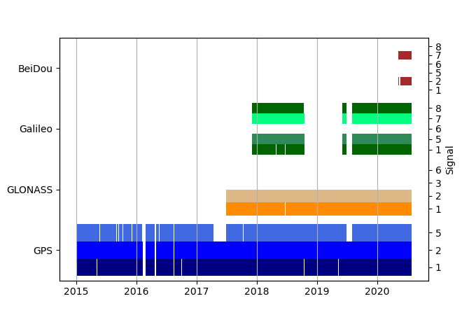
| GNSS Receiver | |
| Mask used |
Data
Zipped data filePlot of daily data
Inventory
Additional Data Sources from tide gauges (guide to additional data sources)
Nearby Real Time Stations from VLIZ: ohig3

