Information
| ID: | 10088 |
| IGS type code: | MAC100AUS |
| Latitude: | -54.499530° |
| Longitude: | 158.935832° |
| Ellipsoidal Height: | -6.767 m |
| Ellipsoidal Height Epoch: | 2019.0000 |
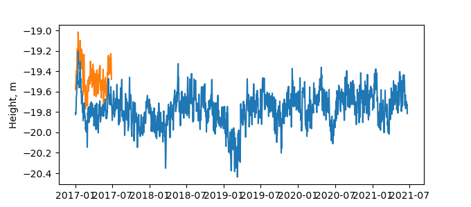
| Reflector Height: | 13.068 m |
| Provider: | Geoscience Australia |
| Alternative Providers: | |
| SONEL Link: | MAC100AUS |
| NGL Link: |
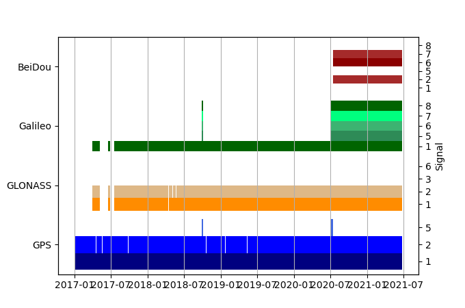
| GNSS Receiver | |
| Mask used |
Data
Zipped data filePlot of daily data
Inventory
Additional Data Sources from tide gauges (guide to additional data sources)
Monthly Mean Data from PSMSL: -184Fast Delivery Data from UHSLC: 680


