Information
| ID: | 10145 |
| IGS type code: | VAGP00USA |
| Latitude: | 37.248622° |
| Longitude: | -76.499374° |
| Ellipsoidal Height: | -21.168 m |
| Ellipsoidal Height Epoch: | 2018.0000 |
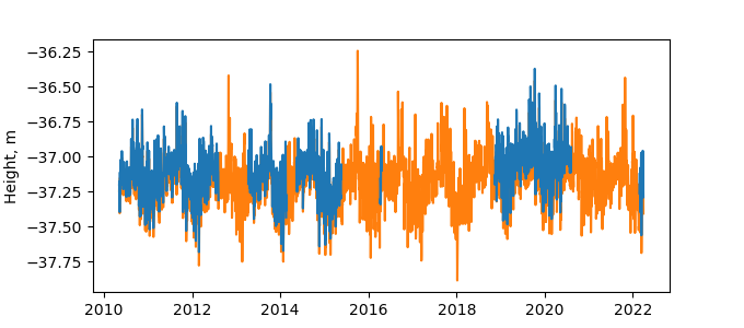
| Reflector Height: | 15.988 m |
| Provider: | NGS |
| Alternative Providers: | UNAVCO,SONEL |
| SONEL Link: | VAGP00USA |
| NGL Link: |
| GNSS Receiver | |
| Mask used |
Data
Zipped data filePlot of daily data
Inventory
Additional Data Sources from tide gauges (guide to additional data sources)
Monthly Mean Data from PSMSL: 597

