Information
| ID: | 10157 |
| IGS type code: | KORO00GRC |
| Latitude: | 36.797501° |
| Longitude: | 21.956296° |
| Ellipsoidal Height: | 28.409 m |
| Ellipsoidal Height Epoch: | 2022.0000 |
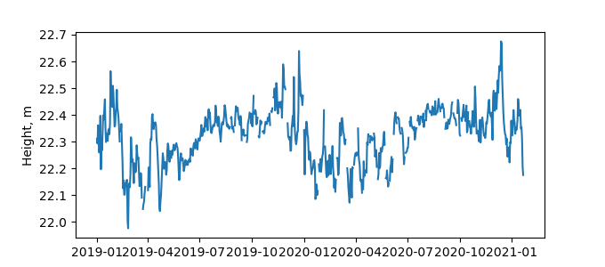
| Reflector Height: | 6.185 m |
| Provider: | NOA |
| Alternative Providers: | SONEL |
| SONEL Link: | KORO00GRC |
| NGL Link: | KOR1 |
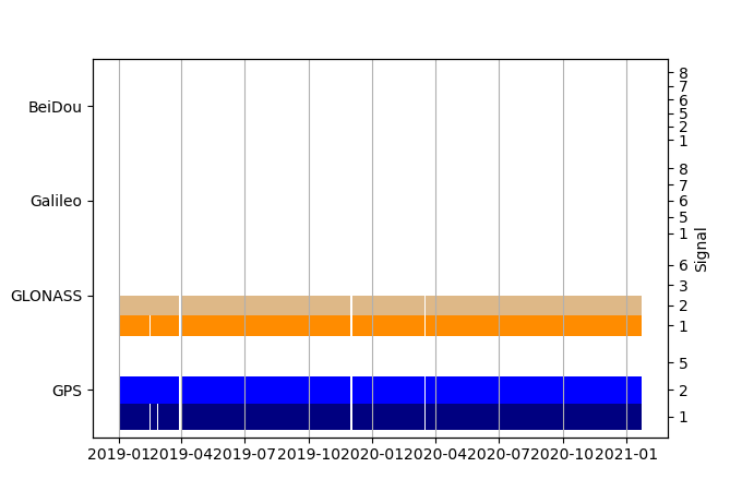
| GNSS Receiver | |
| Mask used |
Data
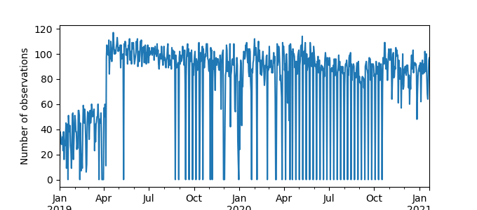
Zipped data filePlot of daily data
Inventory
Additional Data Sources from tide gauges (guide to additional data sources)


