Information
| ID: | 10163 |
| IGS type code: | N00100USA |
| Latitude: | 41.504123° |
| Longitude: | -71.325649° |
| Ellipsoidal Height: | -26.313 m |
| Ellipsoidal Height Epoch: | 2021.0000 |
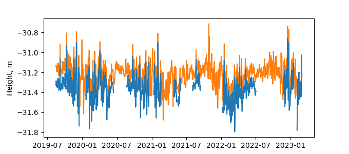
| Reflector Height: | 5.076 m |
| Provider: | NOAA |
| Alternative Providers: | |
| SONEL Link: | N00100USA |
| NGL Link: | N001 |
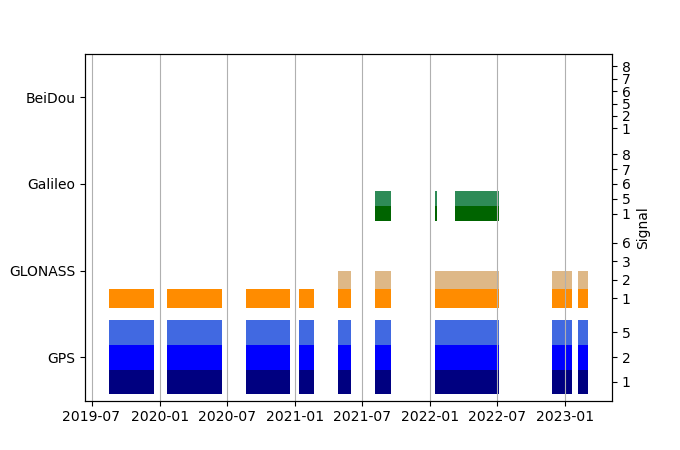
| GNSS Receiver | |
| Mask used |
Data
Zipped data filePlot of daily data
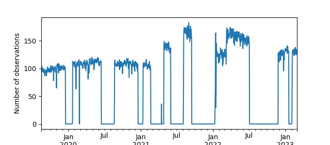
Inventory
Additional Data Sources from tide gauges (guide to additional data sources)
Monthly Mean Data from PSMSL: 351Fast Delivery Data from UHSLC: 253


