Information
| ID: | 10164 |
| IGS type code: | N30000USA |
| Latitude: | 25.731372° |
| Longitude: | -80.161860° |
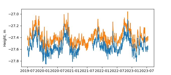
| Ellipsoidal Height: | -22.838 m |
| Ellipsoidal Height Epoch: | 2022.0000 |
| Reflector Height: | 4.750 m |
| Provider: | NOAA |
| Alternative Providers: | |
| SONEL Link: | N30000USA |
| NGL Link: |
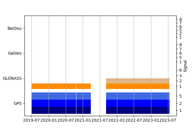
| GNSS Receiver | |
| Mask used |
Data
Zipped data filePlot of daily data
Inventory
Additional Data Sources from tide gauges (guide to additional data sources)
Monthly Mean Data from PSMSL: 1858Fast Delivery Data from UHSLC: 755


