Information
| ID: | 10176 |
| IGS type code: | FFT200MTQ |
| Latitude: | 14.601470° |
| Longitude: | -61.063340° |
| Ellipsoidal Height: | -30.173 m |
| Ellipsoidal Height Epoch: | 2021.0000 |
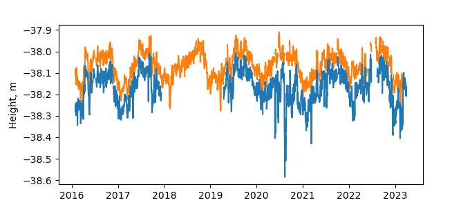
| Reflector Height: | 8.083 m |
| Provider: | RGP |
| Alternative Providers: | |
| SONEL Link: | FFT200MTQ |
| NGL Link: |
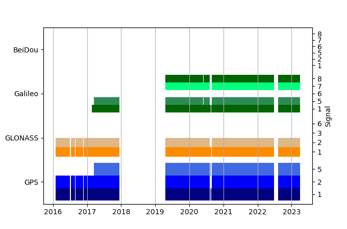
| GNSS Receiver | |
| Mask used |
Data
Zipped data filePlot of daily data
Inventory
Additional Data Sources from tide gauges (guide to additional data sources)
Monthly Mean Data from PSMSL: 1942Nearby Real Time Stations from VLIZ: ftfr2, ftfr
Fast Delivery Data from UHSLC: 271


