Information
| ID: | 10179 |
| IGS type code: | DUNQ00FRA |
| Latitude: | 51.048069° |
| Longitude: | 2.366700° |
| Ellipsoidal Height: | 53.285 m |
| Ellipsoidal Height Epoch: | 2021.0000 |
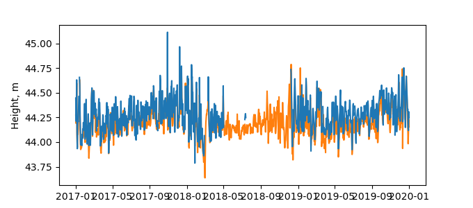
| Reflector Height: | 9.060 m |
| Provider: | RGP |
| Alternative Providers: | SONEL |
| SONEL Link: | DUNQ00FRA |
| NGL Link: |
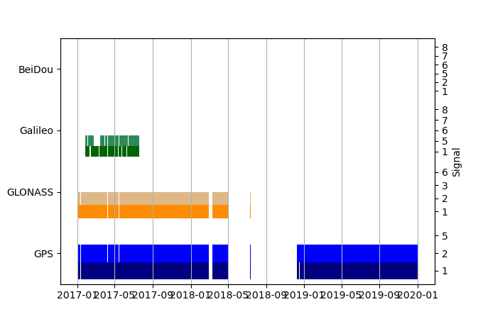
| GNSS Receiver | |
| Mask used |
Data
Zipped data filePlot of daily data
Inventory
Additional Data Sources from tide gauges (guide to additional data sources)
Monthly Mean Data from PSMSL: 468Nearby Real Time Stations from VLIZ: dunk, dunk2


