Information
| ID: | 10186 |
| IGS type code: | DEHA00GLP |
| Latitude: | 16.305290° |
| Longitude: | -61.795920° |
| Ellipsoidal Height: | -35.409 m |
| Ellipsoidal Height Epoch: | 2022.0000 |
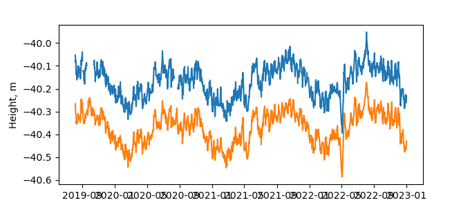
| Reflector Height: | 4.932 m |
| Provider: | RGP |
| Alternative Providers: | SONEL |
| SONEL Link: | DEHA00GLP |
| NGL Link: | DEH1 |
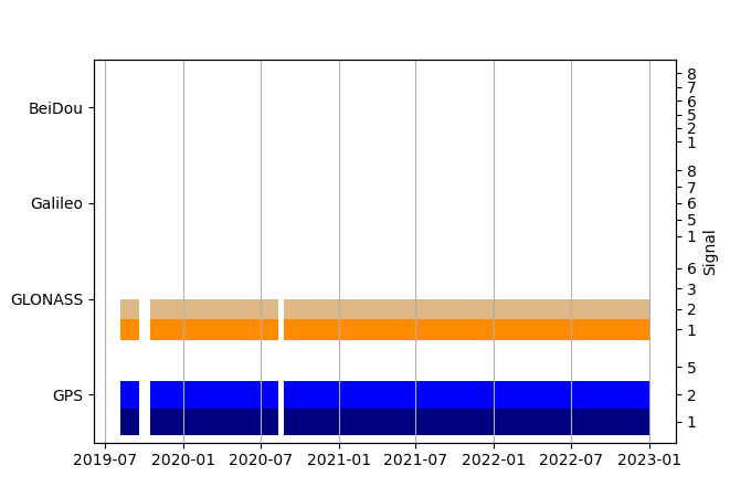
| GNSS Receiver | |
| Mask used |
Data
Zipped data filePlot of daily data
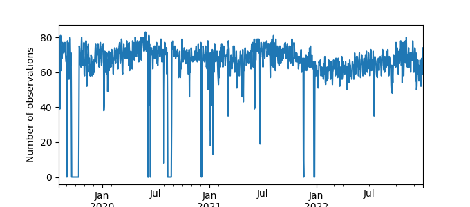
Inventory
Additional Data Sources from tide gauges (guide to additional data sources)
Nearby Real Time Stations from VLIZ: desh

