Information
| ID: | 10187 |
| IGS type code: | PPTG00GLP |
| Latitude: | 16.224370° |
| Longitude: | -61.531640° |
| Ellipsoidal Height: | -36.539 m |
| Ellipsoidal Height Epoch: | 2022.0000 |
| Reflector Height: | 3.959 m |
| Provider: | RGP |
| Alternative Providers: | SONEL |
| SONEL Link: | PPTG00GLP |
| NGL Link: |
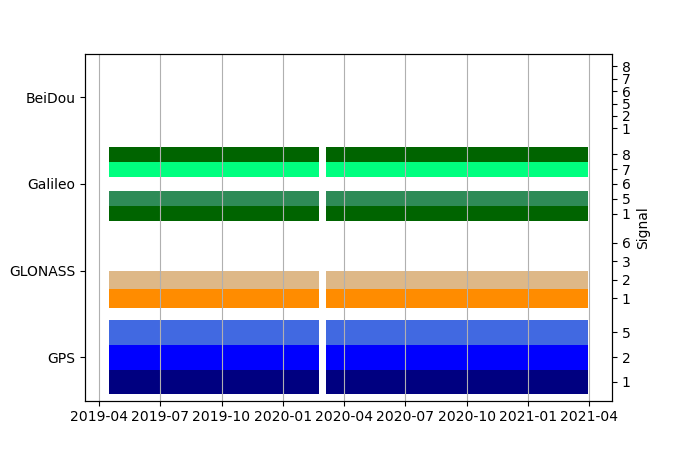
| GNSS Receiver | |
| Mask used |
Data
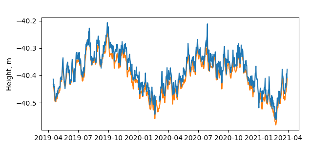
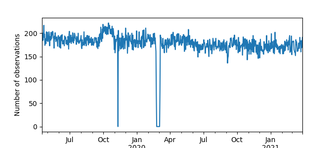
Zipped data filePlot of daily data
Inventory
Additional Data Sources from tide gauges (guide to additional data sources)
Nearby Real Time Stations from VLIZ: ptpt

