Information
| ID: | 10194 |
| IGS type code: | VAR100NOR |
| Latitude: | 70.375010° |
| Longitude: | 31.104010° |
| Ellipsoidal Height: | 25.443 m |
| Ellipsoidal Height Epoch: | 2019.0000 |
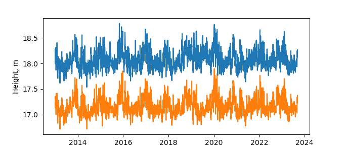
| Reflector Height: | 7.429 m |
| Provider: | SATREF |
| Alternative Providers: | SONEL |
| SONEL Link: | VAR100NOR |
| NGL Link: |
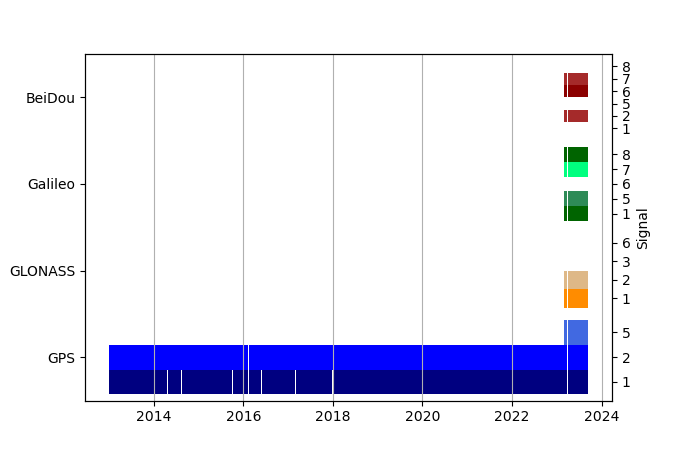
| GNSS Receiver | |
| Mask used |
Data
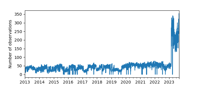
Zipped data filePlot of daily data
Inventory
Additional Data Sources from tide gauges (guide to additional data sources)
Monthly Mean Data from PSMSL: 524Nearby Real Time Stations from VLIZ: vard
Fast Delivery Data from UHSLC: 805


