Information
| ID: | 10203 |
| IGS type code: | LURI00FRA |
| Latitude: | 42.888420° |
| Longitude: | 9.475950° |
| Ellipsoidal Height: | 54.182 m |
| Ellipsoidal Height Epoch: | 2020.0000 |
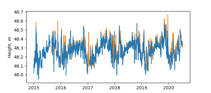
| Reflector Height: | 5.954 m |
| Provider: | SONEL |
| Alternative Providers: | |
| SONEL Link: | LURI00FRA |
| NGL Link: |
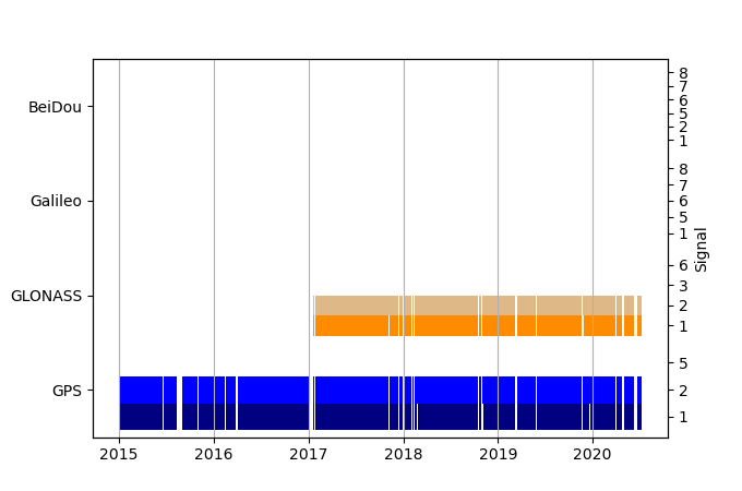
| GNSS Receiver | |
| Mask used |
Data
Zipped data filePlot of daily data
Inventory
Additional Data Sources from tide gauges (guide to additional data sources)
Monthly Mean Data from PSMSL: 2207Nearby Real Time Stations from VLIZ: cent


