Information
| ID: | 10220 |
| IGS type code: | P11100JPN |
| Latitude: | 37.405728° |
| Longitude: | 136.900329° |
| Ellipsoidal Height: | 43.928 m |
| Ellipsoidal Height Epoch: | 2021.0000 |
| Reflector Height: | 6.550 m |
| Provider: | SONEL |
| Alternative Providers: | |
| SONEL Link: | P11100JPN |
| NGL Link: | G111 |
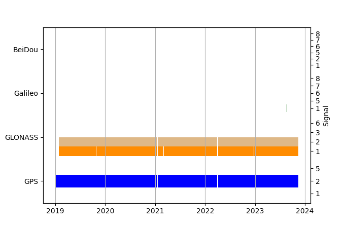
| GNSS Receiver | |
| Mask used |
Data
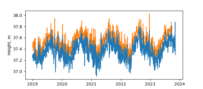
Zipped data filePlot of daily data
Inventory

Additional Data Sources from tide gauges (guide to additional data sources)
Monthly Mean Data from PSMSL: 132

