Information
| ID: | 10239 |
| IGS type code: | P20800JPN |
| Latitude: | 33.475950° |
| Longitude: | 135.773190° |
| Ellipsoidal Height: | 46.391 m |
| Ellipsoidal Height Epoch: | 2020.0000 |
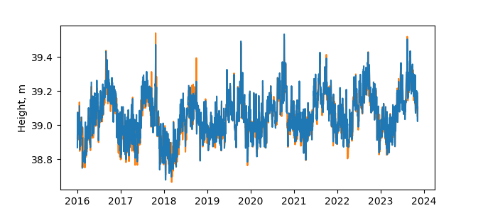
| Reflector Height: | 7.468 m |
| Provider: | SONEL |
| Alternative Providers: | |
| SONEL Link: | P20800JPN |
| NGL Link: | G208 |
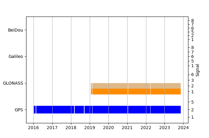
| GNSS Receiver | |
| Mask used |
Data
Zipped data filePlot of daily data
Inventory
Additional Data Sources from tide gauges (guide to additional data sources)
Monthly Mean Data from PSMSL: 134Nearby Real Time Stations from VLIZ: kusm
Fast Delivery Data from UHSLC: 353


