Information
| ID: | 10240 |
| IGS type code: | P20900JPN |
| Latitude: | 34.897330° |
| Longitude: | 132.066220° |
| Ellipsoidal Height: | 39.543 m |
| Ellipsoidal Height Epoch: | 2020.0000 |
| Reflector Height: | 5.939 m |
| Provider: | SONEL |
| Alternative Providers: | |
| SONEL Link: | P20900JPN |
| NGL Link: | G209 |
| GNSS Receiver | |
| Mask used |
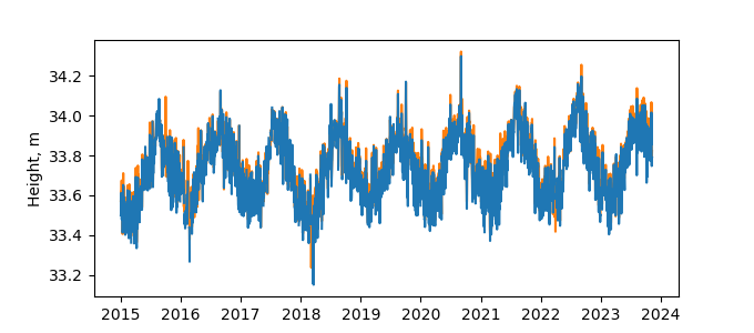
Data
Zipped data filePlot of daily data
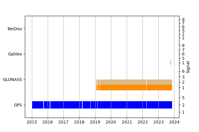
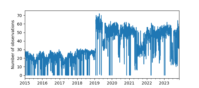
Inventory
Additional Data Sources from tide gauges (guide to additional data sources)
Monthly Mean Data from PSMSL: 1585Nearby Real Time Stations from VLIZ: hmda
Fast Delivery Data from UHSLC: 348


