Information
| ID: | 10250 |
| IGS type code: | SMTG00FRA |
| Latitude: | 48.641083° |
| Longitude: | -2.027465° |
| Ellipsoidal Height: | 62.555 m |
| Ellipsoidal Height Epoch: | 2019.0000 |
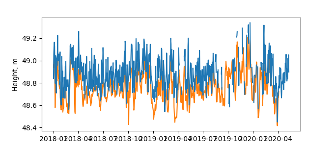
| Reflector Height: | 13.758 m |
| Provider: | RGP |
| Alternative Providers: | SONEL |
| SONEL Link: | SMTG00FRA |
| NGL Link: |
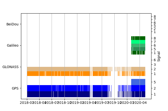
| GNSS Receiver | |
| Mask used |
Data
Zipped data filePlot of daily data
Inventory
Additional Data Sources from tide gauges (guide to additional data sources)
Monthly Mean Data from PSMSL: 454Nearby Real Time Stations from VLIZ: stma, stma2


