Information
| ID: | 10261 |
| IGS type code: | SPTG00ATF |
| Latitude: | -38.714340° |
| Longitude: | 77.531370° |
| Ellipsoidal Height: | 18.020 m |
| Ellipsoidal Height Epoch: | 2019.0000 |
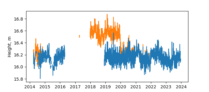
| Reflector Height: | 1.901 m |
| Provider: | SONEL |
| Alternative Providers: | |
| SONEL Link: | SPTG00ATF |
| NGL Link: | SPT2 |
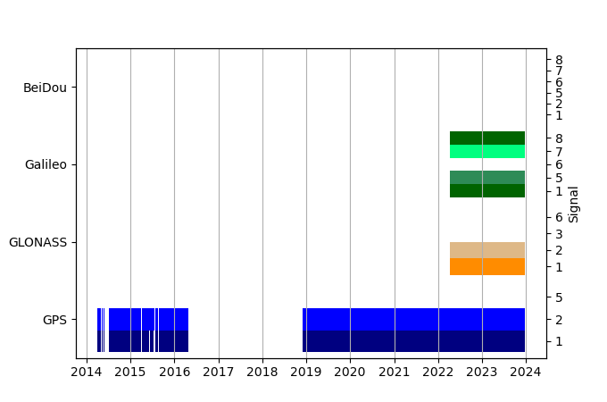
| GNSS Receiver | |
| Mask used |
Data
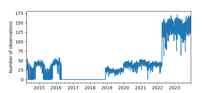
Zipped data filePlot of daily data
Inventory
Additional Data Sources from tide gauges (guide to additional data sources)
Monthly Mean Data from PSMSL: -1863

