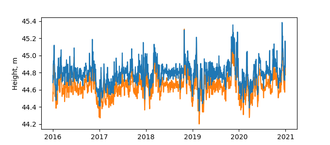
Information
| ID: | 10270 |
| IGS type code: | KOPE00SVN |
| Latitude: | 45.548110° |
| Longitude: | 13.724558° |
| Ellipsoidal Height: | 52.758 m |
| Ellipsoidal Height Epoch: | 2019.0000 |
| Reflector Height: | 8.110 m |
| Provider: | SONEL |
| Alternative Providers: | |
| SONEL Link: | KOPE00SVN |
| NGL Link: |
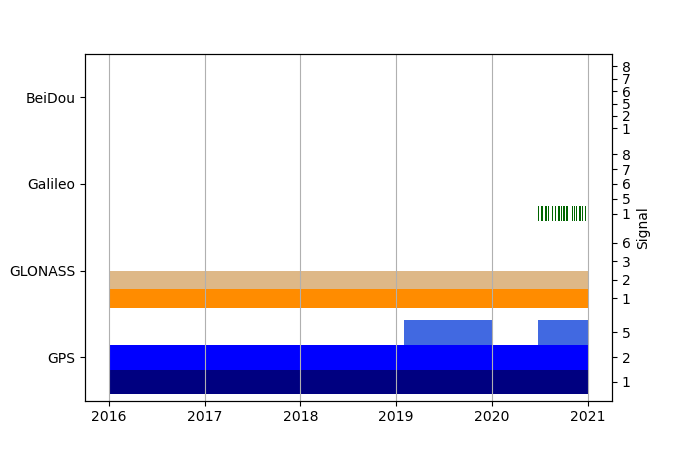
| GNSS Receiver | |
| Mask used |
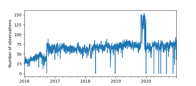
Data
Zipped data filePlot of daily data
Inventory
Additional Data Sources from tide gauges (guide to additional data sources)
Monthly Mean Data from PSMSL: 1817

