Information
| ID: | 10271 |
| IGS type code: | WARN00DEU |
| Latitude: | 54.169789° |
| Longitude: | 12.101427° |
| Ellipsoidal Height: | 50.804 m |
| Ellipsoidal Height Epoch: | 2020.0000 |
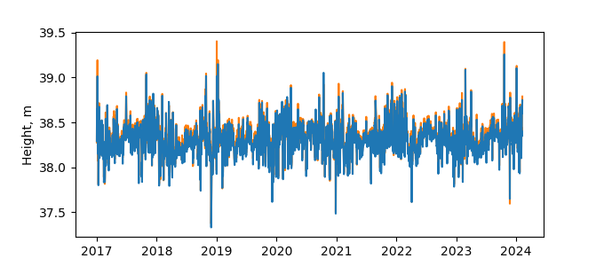
| Reflector Height: | 12.636 m |
| Provider: | SONEL |
| Alternative Providers: | BKG |
| SONEL Link: | WARN00DEU |
| NGL Link: |
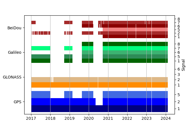
| GNSS Receiver | |
| Mask used |
Data
Zipped data filePlot of daily data
Inventory
Additional Data Sources from tide gauges (guide to additional data sources)
Monthly Mean Data from PSMSL: 11Nearby Real Time Stations from VLIZ: warn


