Information
| ID: | 10287 |
| IGS type code: | TERS00NLD |
| Latitude: | 53.362739° |
| Longitude: | 5.219390° |
| Ellipsoidal Height: | 56.093 m |
| Ellipsoidal Height Epoch: | 2020.0000 |
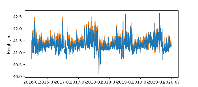
| Reflector Height: | 14.837 m |
| Provider: | TUD |
| Alternative Providers: | SONEL |
| SONEL Link: | TERS00NLD |
| NGL Link: |
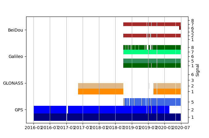
| GNSS Receiver | |
| Mask used |
Data
Zipped data filePlot of daily data
Inventory
Additional Data Sources from tide gauges (guide to additional data sources)
Monthly Mean Data from PSMSL: 236Nearby Real Time Stations from VLIZ: ters


