Information
| ID: | 10303 |
| IGS type code: | KULL00GRL |
| Latitude: | 74.580630° |
| Longitude: | -57.227050° |
| Ellipsoidal Height: | 94.101 m |
| Ellipsoidal Height Epoch: | 2020.0000 |
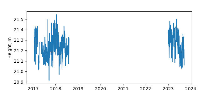
| Reflector Height: | 72.978 m |
| Provider: | UNAVCO |
| Alternative Providers: | |
| SONEL Link: | |
| NGL Link: |
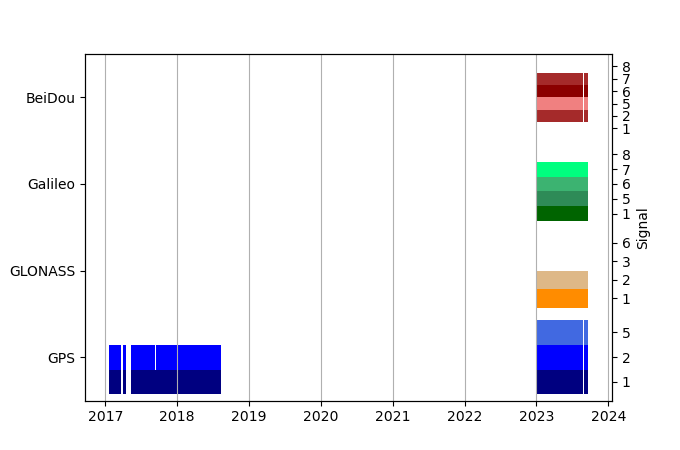
| GNSS Receiver | |
| Mask used |
Data
Zipped data filePlot of daily data
Inventory
Additional Data Sources from tide gauges (guide to additional data sources)


