Information
| ID: | 10314 |
| IGS type code: | TGDR00DOM |
| Latitude: | 18.208047° |
| Longitude: | -71.091960° |
| Ellipsoidal Height: | -27.195 m |
| Ellipsoidal Height Epoch: | 2023.0000 |
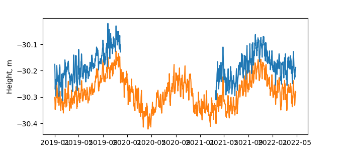
| Reflector Height: | 3.090 m |
| Provider: | UNAVCO |
| Alternative Providers: | |
| SONEL Link: | TGDR00DOM |
| NGL Link: |
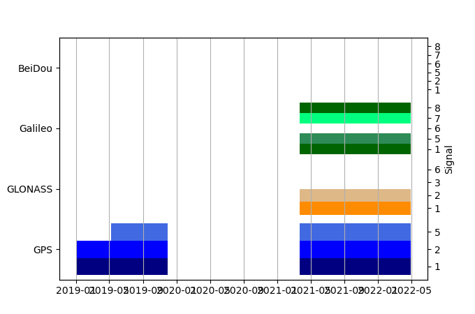
| GNSS Receiver | |
| Mask used |
Data
Zipped data filePlot of daily data
Inventory
Additional Data Sources from tide gauges (guide to additional data sources)
Monthly Mean Data from PSMSL: 745Nearby Real Time Stations from VLIZ: bara


