Information
| ID: | 10334 |
| IGS type code: | ROBN00ATA |
| Latitude: | -65.246500° |
| Longitude: | -59.444631° |
| Ellipsoidal Height: | 57.948 m |
| Ellipsoidal Height Epoch: | 2019.0000 |
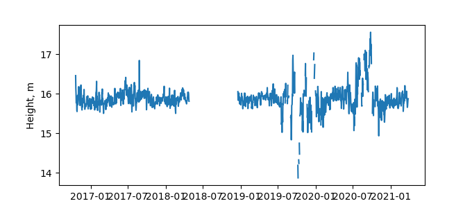
| Reflector Height: | 42.235 m |
| Provider: | UNAVCO |
| Alternative Providers: | |
| SONEL Link: | |
| NGL Link: |
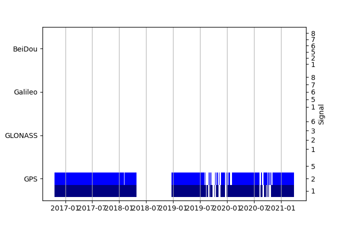
| GNSS Receiver | |
| Mask used |
Data
Zipped data filePlot of daily data
Inventory
Additional Data Sources from tide gauges (guide to additional data sources)


