Information
| ID: | 10347 |
| IGS type code: | ROB400ATA |
| Latitude: | -77.034440° |
| Longitude: | 163.190111° |
| Ellipsoidal Height: | -41.608 m |
| Ellipsoidal Height Epoch: | 2020.0000 |
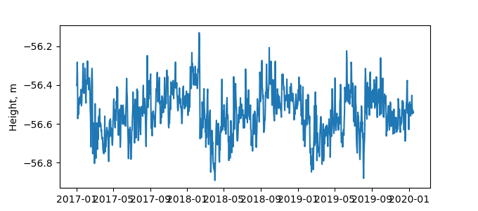
| Reflector Height: | 14.988 m |
| Provider: | UNAVCO |
| Alternative Providers: | |
| SONEL Link: | ROB400ATA |
| NGL Link: |
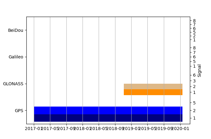
| GNSS Receiver | |
| Mask used |
Data
Zipped data filePlot of daily data
Inventory
Additional Data Sources from tide gauges (guide to additional data sources)


