Information
| ID: | 10356 |
| IGS type code: | NANO00CAN |
| Latitude: | 49.294810° |
| Longitude: | -124.086480° |
| Ellipsoidal Height: | 6.690 m |
| Ellipsoidal Height Epoch: | 2019.0000 |
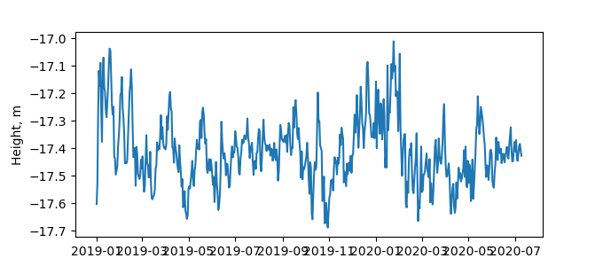
| Reflector Height: | 24.248 m |
| Provider: | WCDA |
| Alternative Providers: | |
| SONEL Link: | NANO00CAN |
| NGL Link: |
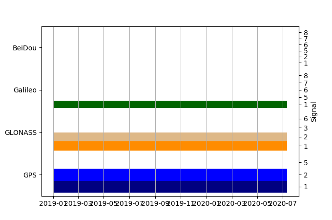
| GNSS Receiver | |
| Mask used |
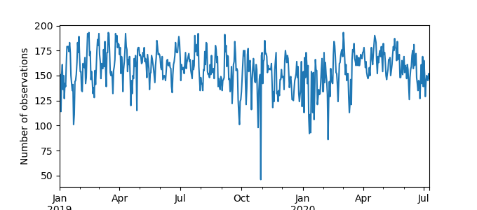
Data
Zipped data filePlot of daily data
Inventory
Additional Data Sources from tide gauges (guide to additional data sources)


