Information
| ID: | 10368 |
| IGS type code: | TA0100DNK |
| Latitude: | 56.146578° |
| Longitude: | 10.222673° |
| Ellipsoidal Height: | 45.003 m |
| Ellipsoidal Height Epoch: | 2020.0000 |
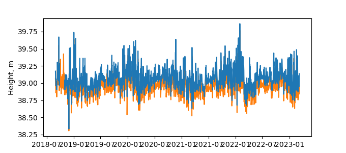
| Reflector Height: | 6.086 m |
| Provider: | TAPAS |
| Alternative Providers: | |
| SONEL Link: | TA0100DNK |
| NGL Link: |
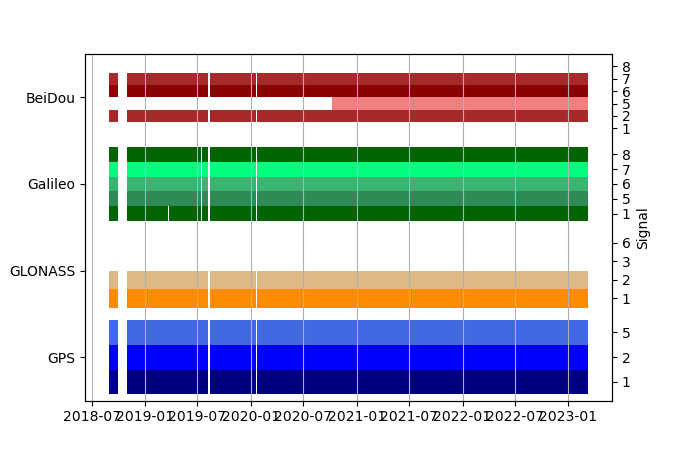
| GNSS Receiver | |
| Mask used |
Data
Zipped data filePlot of daily data
Inventory
Additional Data Sources from tide gauges (guide to additional data sources)
Monthly Mean Data from PSMSL: 76

